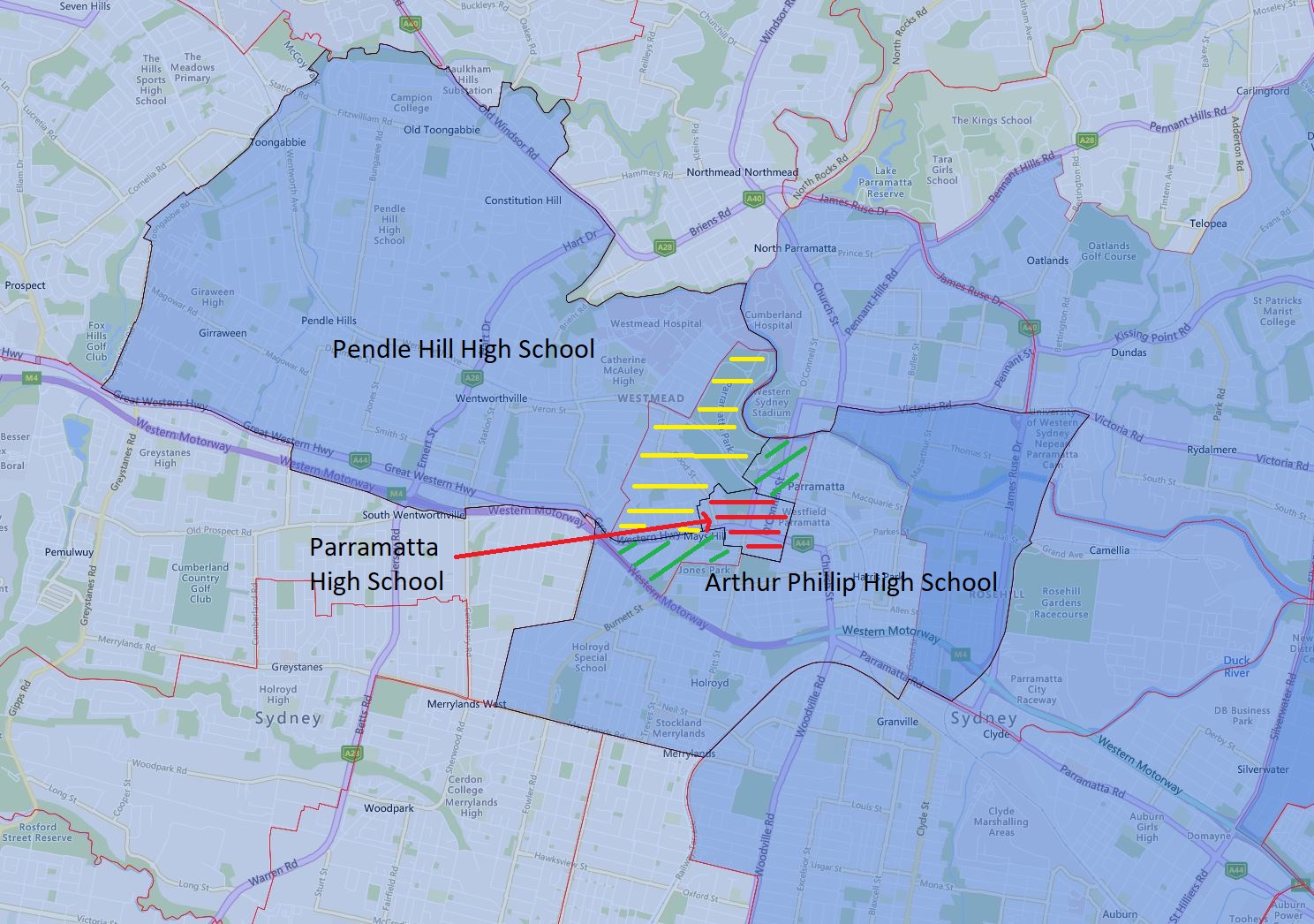
The centerpiece of this update is the dramatic shrinking of the catchment of Parramatta High School in 2024.
The red-striped area is all Parramatta High School retained in the catchment in 2024. This change is very dramatic and will result in a massive shrinking in its regular enrolment number. That being said Parramatta High School is a partial selective, so depending on the number of selective intakes, the total change may not be as dramatic as the map may suggest.
The green-striped area is transferred from Parramatta High School to Arthur Phillip High School in 2024. It is a mix of low to medium and high-density dwellings, that being said most look to be converting to higher-density residences.
The yellow-striped area is transferred from Parramatta High School to Pendle Hill High School in 2024. This is a very significant area basically everything south of the railway, east of Hawkesbury Road, and north of the Parramatta Road. It is a mix of low to medium and high-density residences as well.
The black border is the 2024 catchment boundary and the red is the 2023 boundary.
The most common name used by the NSW Department of Education is “catchment” which refers to those students who reside in a particular area and are guaranteed a position in specific schools. When discussed from the perspective of a particular school is often referred to as one of the following terms.
- School Zone
- School intake area
- School catchment
As usual contact the school in question or the Department of Education for the final confirmation and you can also access the full NSW and Sydney High School Catchment Map by following this link.
Share this post:
 Email This Post