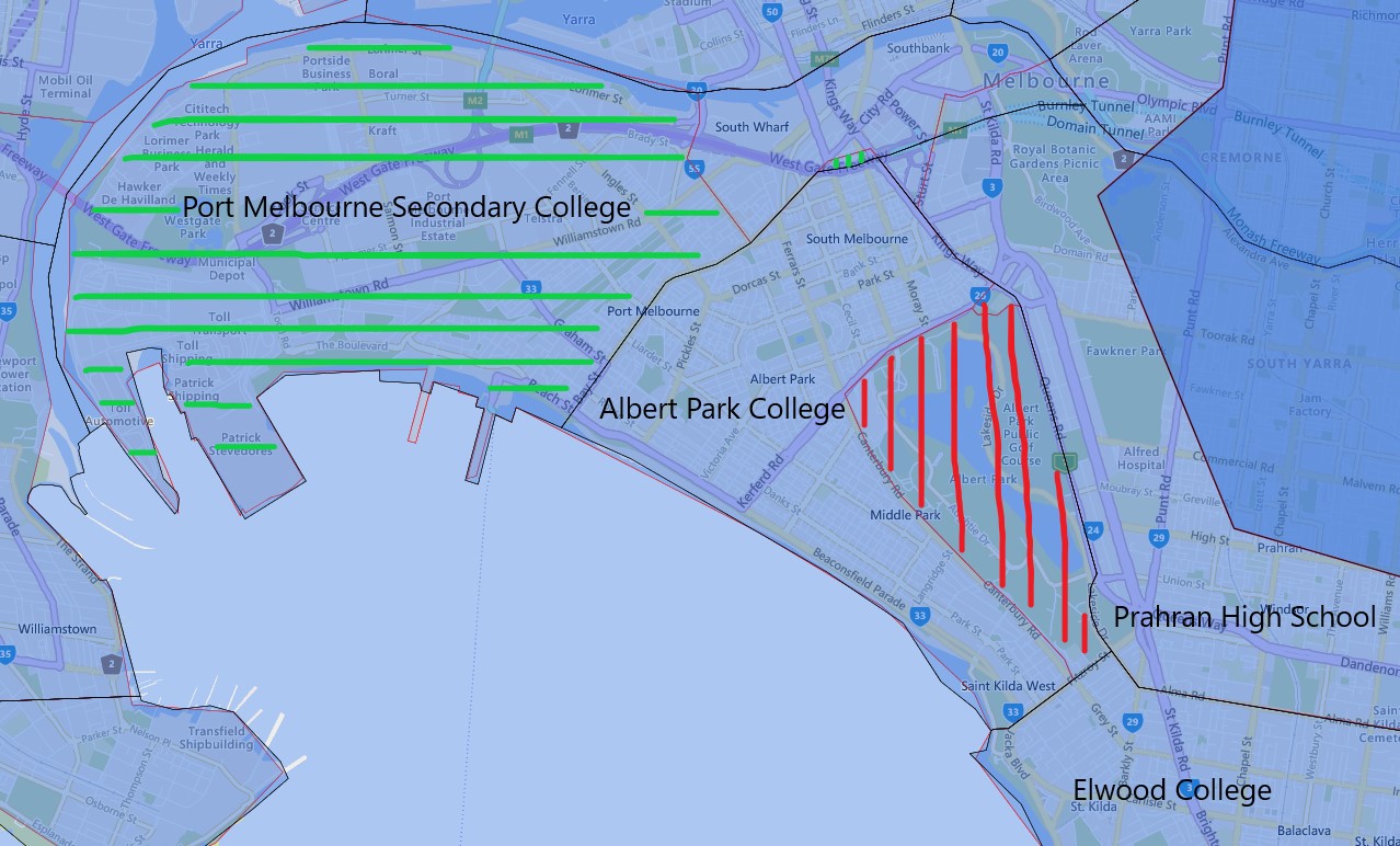
With the opening of Port Melbourne Secondary College in 2022, there is a drastic change to the existing school zone for Albert Park Secondary College.
Everything west of the Bay street and City road is now part of the school zone of the newly established Port Melbourne Secondary College in 2022 for year 7. The little strip of the area north of West Gate Freeway also has been transferred to the Port Melbourne Secondary College as well. The green striped area is what covers the above changes.
The red striped area is Albert Park and is transferred to Albert Park Secondary College from Elwood College in 2022, but since there are no residential buildings as far as I can see there will not be any impact to enrolment from this part of the change.
The red borders are the 2021 and the black borders are the 2022 school zone borders.
The proper name used by the Victorian Department of Education is called “Designated neighbourhood school” which is what a particular address is zoned for the particular school. When discussed from the perspective of a particular school is often referred to as one of the following terms.
- Designated neighbourhood zone
- Designated neighbourhood boundary
- Neighbourhood zone
- School Zone
- School intake area
- School catchment
For the final confirmation please contact the school in question. You can also find the full Melbourne, Victoria public school zone map by clicking on the link.
Share this post:
 Email This Post
Hi
Could you please let me know 338 kings way , south Melbourne is in your school zooon? Many thanks!
Elaine
Hi Elaine,
This address appears to be zoned for Albert Park Secondary College, please contact the school in question for final confirmation.