North Ryde Public School

North Ryde Public School was originally called City View Public School and established in 1876. The school changed its name to the current North Ryde Public School in 1877. The original building in Coxs Road was a brick and sandstone building which now houses the NSW Schoolhouse Museum of Public Education. It is one of the oldest school buildings in New South Wales(#1). There is a good chance that if your children is studying in one of the public school in Sydney, that they will end up visiting the museum one day.

North Ryde Public School is located on the Coxs road near the intersection with the Lane Cove Rd. In 2014 there are 282 students enrolled in the school and this is increase of 16% over the 238 students enrolled in 2008. This is probably higher increase than average school would see in the same time period, but certainly not the most extreme as well. In 2014, 50 percent of the students in the school are from none English language background. This number had not changed much since 2008, which actually is a little surprising. I am expecting this number to rise over the next few years, there are a lot of Asian buying into the suburb in the last few years.

North Ryde Public School has been doing very well recently academically and rising steadily in rank in general.

20102011201220132014
Ranking74121495637

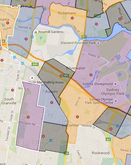
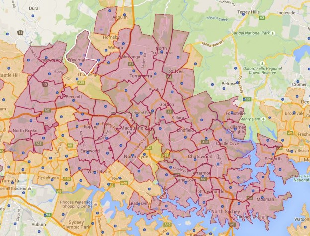
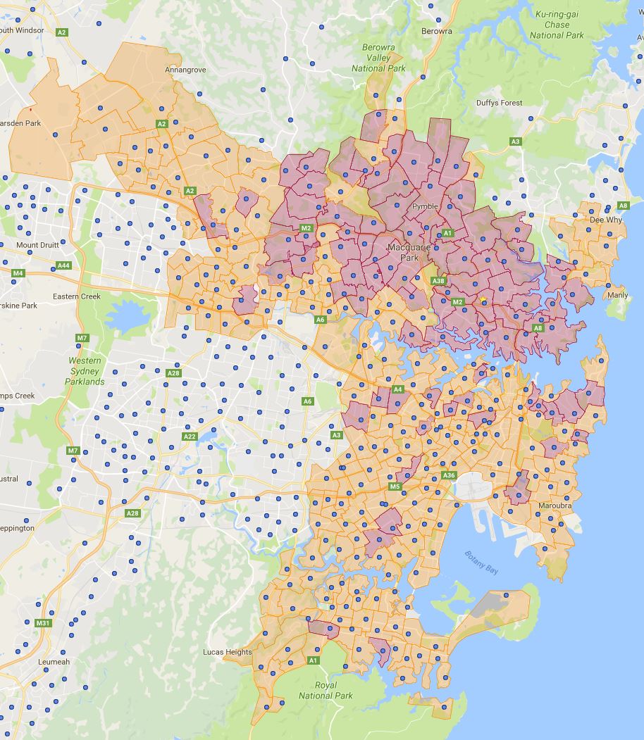
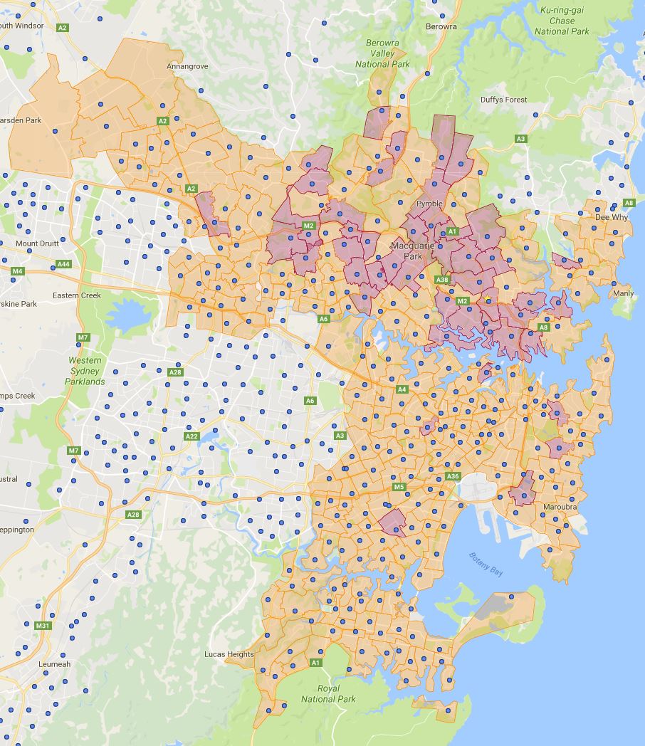
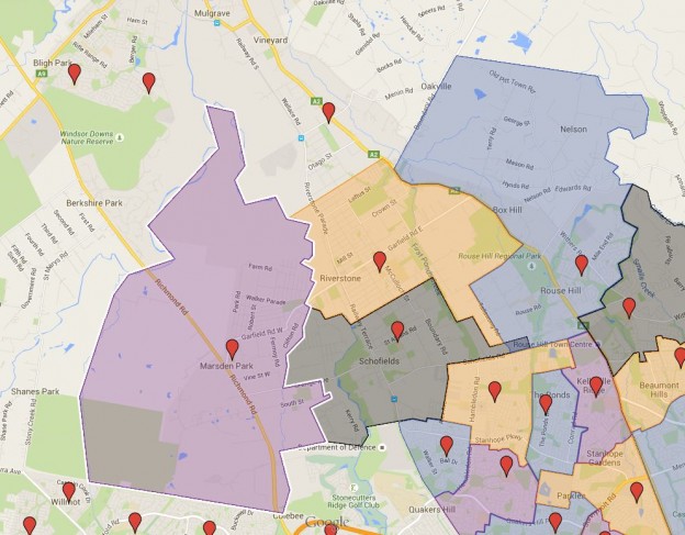
North Ryde Public School Catchment is bounded by the Shrimpton creek to the west and Lane Cove river to the north, Wicks road to the east and Quarry Road to the south. The catchment is mostly single dwellings, also a mix of medium density dwellings as well.

North Ryde Public School Catchment

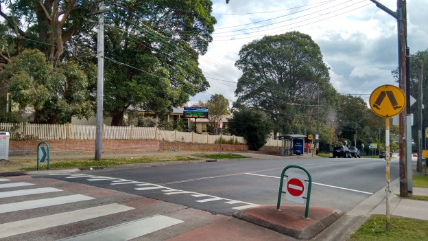
North Ryde Public School is located not near any train stations despite the same name train station on the Chatswood-Epping line. For out of area students, bus and car are the only real option, unless you are ready to do fair bit of walking.

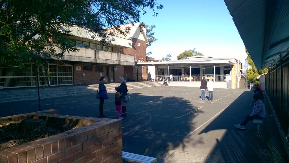
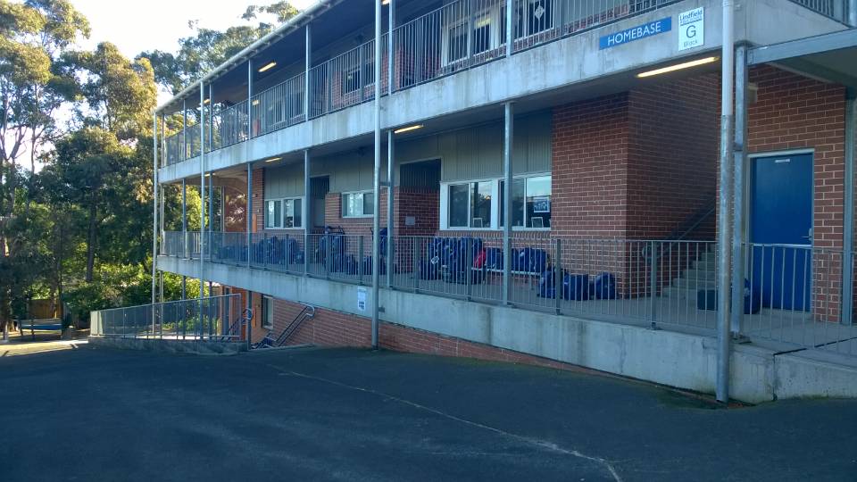
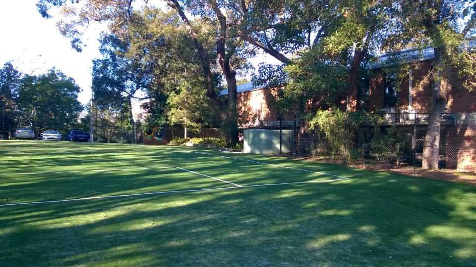
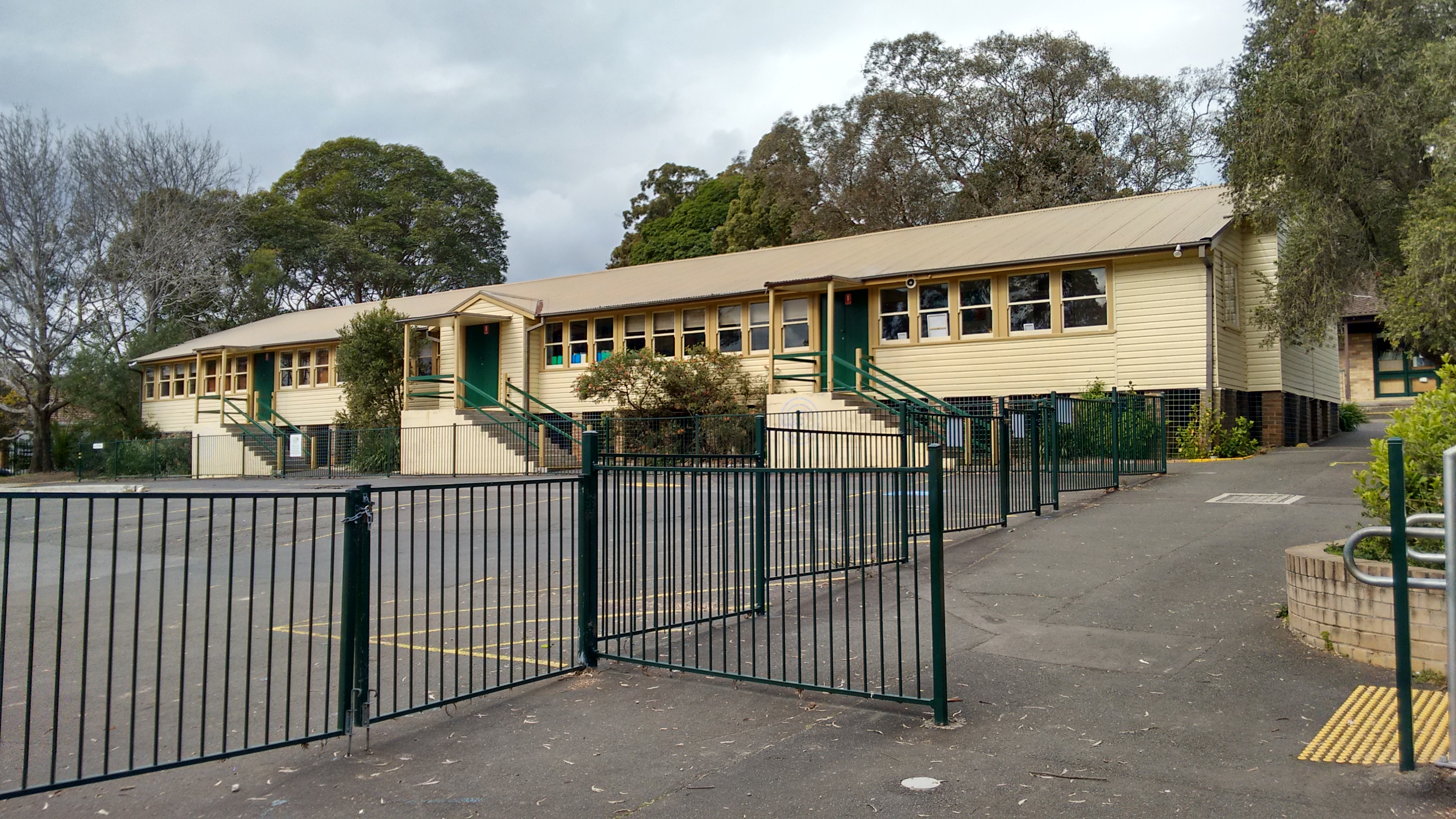
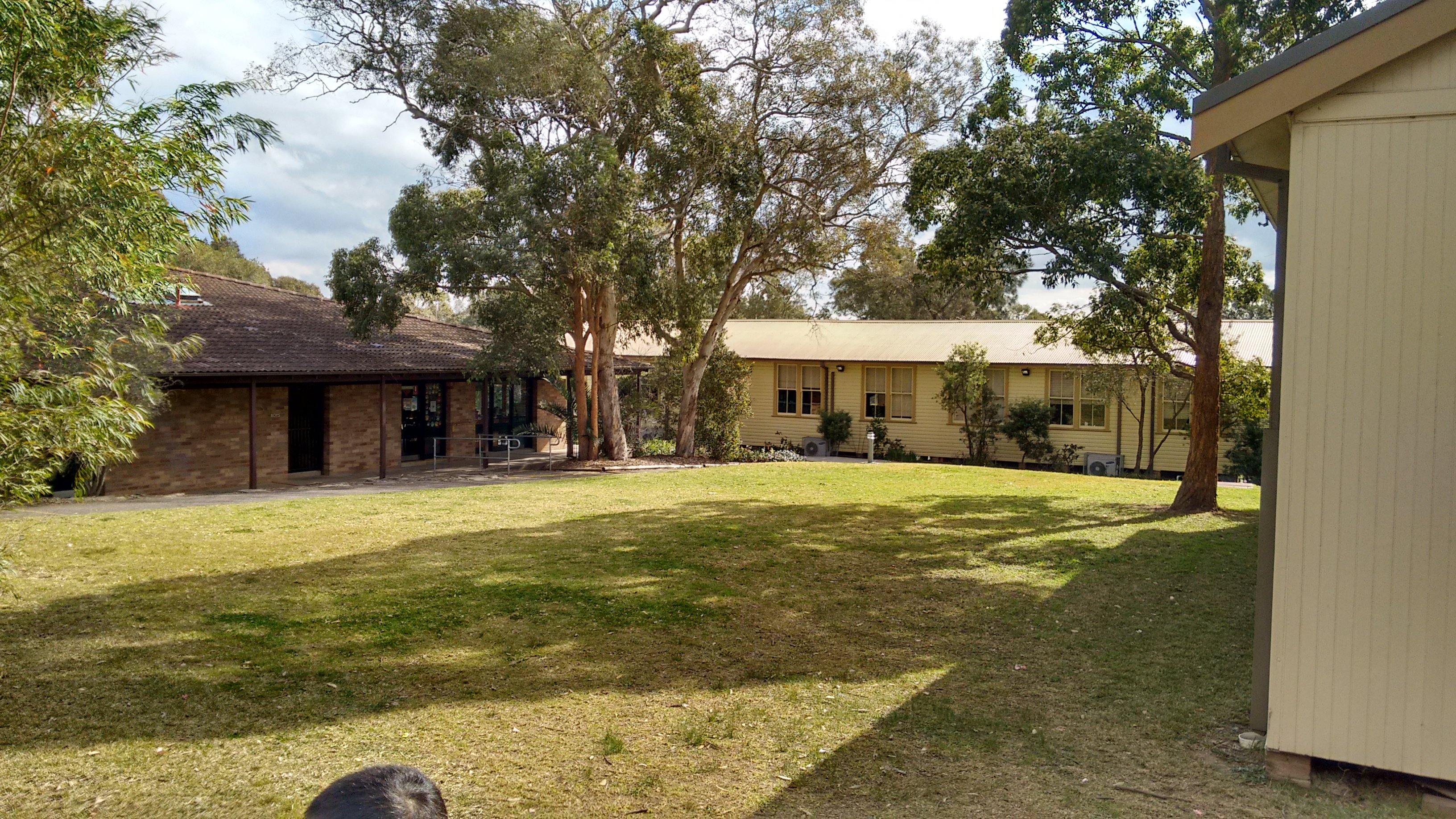
I was a bit surprised when visiting that there are no real new buildings for the school, most of public schools I visited got new building or builds constructed during 2008 GFC stimulus period, North Ryde public school is one exception by the look of it. The school got real good playgrounds and open area for the number of students enrolled.

IMG_20150815_133856791_HDR


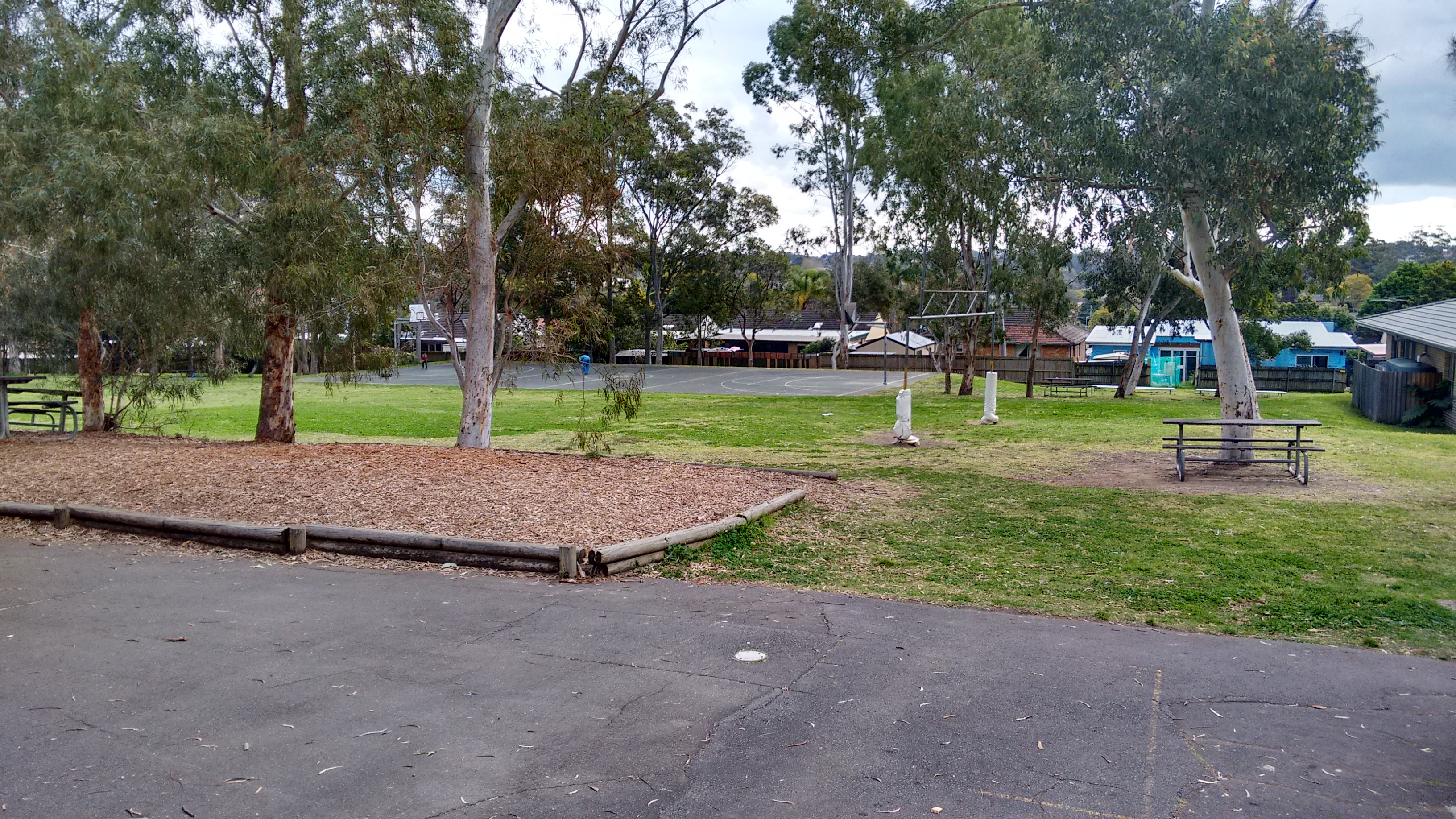
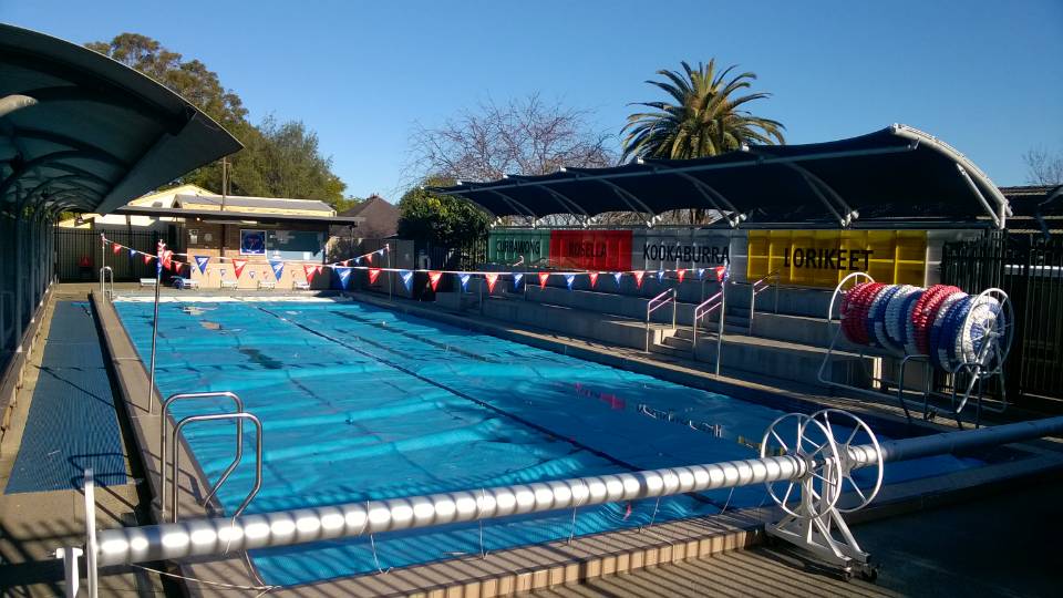
Following are a few shots of the buildings in the North Ryde Public School, most of buildings are of similar type and look. There are plenty of space in the school in comparison to most I have visited and with the increase population and demand, I would not be surprised with a future expansion and new permanent and temp buildings to be put in.

IMG_20150815_133912807_HDR IMG_20150815_133518743_HDR

As usual contact the school in question or department of education for the final confirmation and you can also access the full catchment map by following this link.


  1. http://www.schoolhousemuseum.org.au/

Auburn, Auburn North, Auburn West, Berala, Homebush West, Lidcombe and Rosehill Public School Catchment Map Added

Western Sydney today again and seven more public school catchment added. Some of this set is very shaky, particular the Homebush West Public School’s catchment, the catchment is way too small for the number of student enlisted for 2014. I suspect the parts of neighbouring catchments all got parts belong to it as well.

  • Auburn Public School
  • Auburn North Public School
  • Auburn West Public School
  • Berala Public School
  • Homebush West Public School
  • Lidcombe Public School
  • Rosehill Public School

As usual contact the school in question or department of education for the final confirmation and you can also access the full catchment map by following this link.

Lindfield Public School

Lindfield Public School is one of the older more established school in the north shore area. The school is located on the corner of Pacific High Way and Grosvenor I have done some research and only after some innovative searches, I was managed to confirm the school was established in 1903.

In 2014 there are 725 students enrolled in the school which is an increase of 10 per cent over the 660 students enrolled in 2008. It has not seen the significant increase in the enrolment like many other public schools in the north shore area. The main reason is likely that Lindfield Public School is pretty much at max capacity and you simply cannot squeeze much more students into the school. The new public school in west Lindfield will come into play in a few years which should relieve the pressure it is currently under. Once the new public school opens then the catchment for Lindfield Public School will change significantly and likely will have flow on for other nearby public schools like Roseville and Chatswood etc.

In 2014 students with a language background other than English sits at 35 per cent. Lindfield Public School also performs very well academically and consistently rank in the top of the state public schools.

20102011201220132014
Ranking58
69304726

Its catchment straddles both sides of Pacific High Way and the North Shore Railway. The catchment consist mix of single and multi-dwellings. The multi dwellings concentrated around East of Pacific High Way and around the Lindfield Railway Station. You can search for a particular school or address in the search box in the top right-hand corner of the embedded map or zoom into an area of interest on the map.

The school itself is located just a stone’s throw away from the Lindfield railway station which made is very easily accessible by public transport.

As with most of older public schools, there is a mix of old and new buildings. The school contain a swimming pool as well which is very handy. However there are very little playgrounds in the school, this is actually likely is one of the more crowded schools in the north shore area.

mmexport1440161904321 mmexport1440161882495 mmexport1440161894754 mmexport1440161899657

As usual contact the school in question for the final confirmation and you can also access the full catchment map by following this link.


Kings Langley, Lalor Park, Lynwood Park, Seven Hills and Seven Hills West Public School Catchment Map Added

After the nice little break, I am getting back to adding catchment maps again. This set of maps are for the lovely western Sydney.

  • Kings Langley Public School
  • Lalor Park Public School
  • Lynwood Park Public School
  • Seven Hills Public School
  • Seven Hills West Public School

This set of maps are very shaky, so I highly recommend as usual contact the school in question for the final confirmation and you can also access the full catchment map by following this link.

Where are the top public schools in Sydney located

I just finished mapping the top 50 and 100 Sydney, NSW public school which you can find them in the previous two entries at

Year 2014 Top 50 NSW Public School Catchment Map

and

Year 2015 Top 100 Sydney, NSW Public School Catchment Map

It is actually very interesting how concentrated the top public schools for NSW are located. 91 out of the 100 top public school are located in Sydney two of which are special schools, 2 in New Castle, 1 in Wollongong, 1 in Central Coast and 5 in country NSW. To give some prospective in pure population wise, 62 percent of NSW population lives in Sydney, however 89 percent of top 100 state’s public schools are in Sydney. The concentration is even higher when you looking at the top 50, 46 out of the top 50 state’s public school is in Sydney for the year 2014. There is another top 50 that is located in Sydney which not included in the count that is the Sydney Distance Education Primary School.

If you lived in Sydney for any period of time, you will likely know that there are a lot of good schools in the northern Sydney. I was still a little surprised once the top schools are mapped out and how concentrated they are in the northern Sydney. As you can see from my top 50 Sydney NSW public school catchment map that only 6 out of the 46 Sydney’s top public school is located outside of Northern Sydney.

First I want to mention that the breakdown of region is approximate as there is really no exact definition which suburb belong to which Sydney regions.

Number of Public Schools in each respective Sydney area that are in top 50 in NSW. Another interesting point to note when looking the stats is that Western,  South Western Sydney and Shire district are not represented in the list at all.

  • North Shore: 23
  • Northern Suburbs: 13
  • Hills District: 3
  • Eastern Suburbs: 3
  • Inner West: 2
  • Northern Beaches: 1
  • Southern Suburbs: 1

This is the number of Public Schools in each respective Sydney area that are in top 100 in NSW. South western Sydney is again not represented at all, Western Sydney and Shire district only have marginal presence in the list.

  • North Shore: 34
  • Northern Suburbs: 19
  • Inner West: 10
  • Eastern Suburbs: 8
  • Hills District: 7
  • Northern Beaches: 5
  • Southern Suburbs: 2
  • Western Sydney: 2
  • Shire District: 2

What is also interesting to note is that just about every suburb is North Shore and Northern Suburbs are represented in the top 100 list. This is also why in my opinion picking a school is not as important when you are buying properties in the North Shore and Northern Suburbs, because just about every local public school is very good.

I may do a follow up entry in the future to do some further analysis on why the concentration of good public schools in North Sydney. If I get time I will try also collect some other stats to facilitate this.

As usual contact the school in question for the final confirmation and you can also access the full catchment map by following this link.

Year 2014 Top 100 Sydney, NSW Public School Catchment Map

This is a follow up of the last map showing the top 100 NSW public school in Sydney. I hope your guys enjoyed it as much as I had. I will do a brief analysis entry on the two maps which just got created. Looking at the maps visually certainly reinforced a lot what we know already.

year-2014-top-100-nsw-public-school-catchment-map

For reference there are 11 out of 100 not mapped, two of them are special type school with catchment defined. So this entry added additional 42 schools to the 47 of last entry. There is only one top 100 school in Sydney that there is no catchment map already created for it.

As usual contact the school in question for the final confirmation and you can also access the full catchment map by following this link.

  1. Ranking is obtained using information from bettereducation.

Year 2014 Top 50 NSW Public School Catchment Map

I am a geek at heart and now that I am older, I have fully embraced the fact. I always have great interest in public education and like many people lived Sydney already know rough where the top state public schools are located. However knowing roughly is different from looking at the exact locations on the map. With 300 Sydney public school catchment completed recently I have a good base to draw this data onto. Without further ado, here is the promised fun work for your guys to enjoy.

Check out the top 50 Sydney NSW public school in map.

year-2014-top-50-nsw-public-school-catchment-map

There are only 3 odd ball out in the top 50 list, with one being the Sydney Distance Education Primary School and other two located outside of Sydney and yet to be mapped. The other 47 are covered by the existing map already.

I got some more mapping to do and will do a discussion of this in a future post.

As usual contact the school in question for the final confirmation and you can also access the full catchment map by following this link.

  1. Ranking is obtained using information from bettereducation.

Mid Life Upgrade for Sydney Public School Map

This is a bit off topic, I am sharing the things that I have learned while doing mapping using Google map.

The default marker is monstrously big and it is fine when you only have a few of them. However if you like me already up to around 600 and will going up more in the future. The map when zoomed became a bit of a mess. The default market is not only just 32 by 32 pixel, the shape of it also make it rather large.

If you export the map into kml and look at the actual file, you will notice that bits look like following


<IconStyle>
<color>ff3644DB</color>
<scale>1.1</scale>
<Icon>
<href>http://www.gstatic.com/mapspro/images/stock/503-wht-blank_maps.png</href>
</Icon>
<hotSpot x=’16’ y=’31’ xunits=’pixels’ yunits=’insetPixels’>
</hotSpot>
</IconStyle>

The url is what marker graphic will be used, there are a lot of them available, the default one is 32 by 32 pixel which is in my view really too big for a lot of applications.

Here is a smaller sized red circle marker

https://storage.googleapis.com/support-kms-prod/SNP_2752125_en_v0

I started using the new marker, however the marker does not stay in the same spot on different level of zoom. Same does not seem to apply with the default market. After a bit of research, look like the market need to be “anchored” to fix this issue. Then it is off to more “research” which is really google searches. I finally find the answer, it is the

<hotSpot x=’16’ y=’31’ xunits=’pixels’ yunits=’insetPixels’>

The kml exported by default uses pixels and it is for the 32 by 32 pixels marker, so when you use a smaller marker you will the markers moving when zooming. The easiest solution I find is just change to use fraction in the hotspot tag as following.

<hotSpot x=’0.5′ y=’0.5′ xunits=’fraction’ yunits=’fraction’>

So after a couple hours of work, now I finally got rid of that gigantic default markers. Enjoy the new mid life upgraded Sydney Public School full catchment map by following this link.

Marsden Park, Riverstone and Rouse Hill Public School Catchment Map Added

I finally finished the Southern Sydney and can move onto the other areas after spending the whole month down there. This update is in  the north west growth area again with three more school catchment map added.

This update coincidentally also bring the total public school catchment to 300 as well. It certainly is a major milestone for me.

  • Marsden Park Public School
  • Riverstone Public School
  • Rouse Hill Public School

As usual contact the school in question for the final confirmation and you can also access the full catchment map by following this link.

Engadine, Engadine West, Heathcote, Heathcote East, Loftus, Marton and Yarrawarra Public School Catchment Map Added

The final seven school for shire district added, southern Sydney is finally done. /dance, /sing whatever and I am so excited about this. Now have to decide which region to move back into after this, this has been fun so far and I really appreciate your guys going alone on this trip with me.

  • Engadine Public School
  • Engadine West Public School
  • Heathcote Public School
  • Heathcote East Public School
  • Loftus Public School
  • Marton Public School
  • Yarrawarra Public School

As usual contact the school in question for the final confirmation and you can also access the full catchment map by following this link.

en_AUEnglish (Australia)