St Ives High School Catchment Map Added

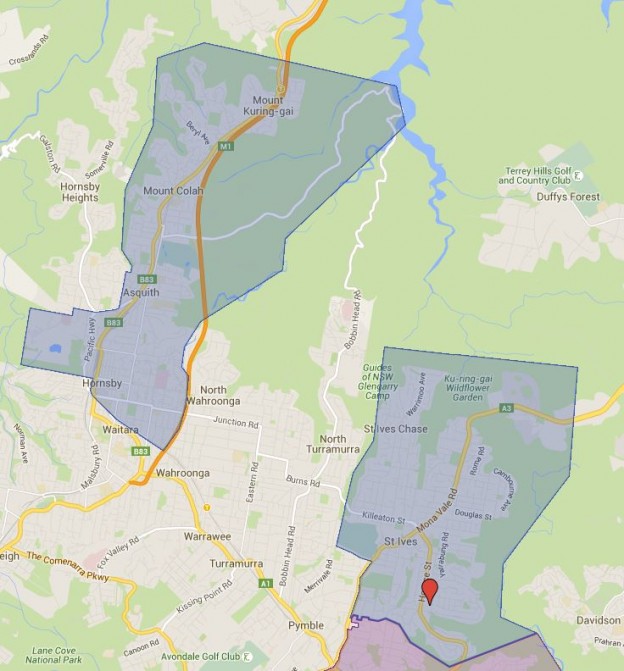
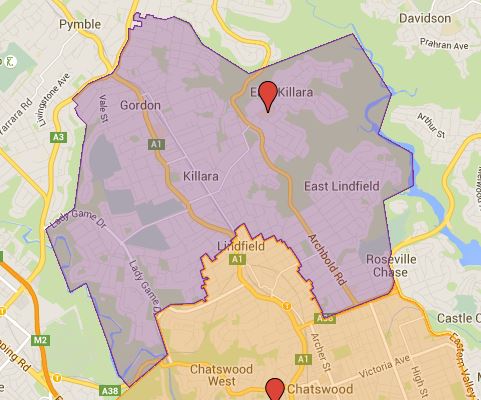
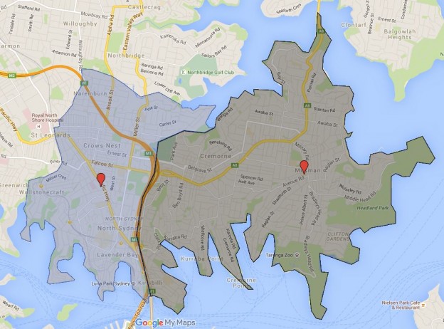
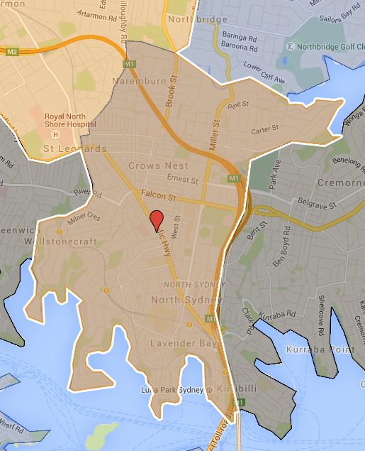
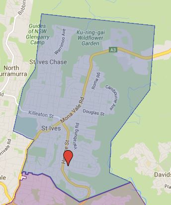
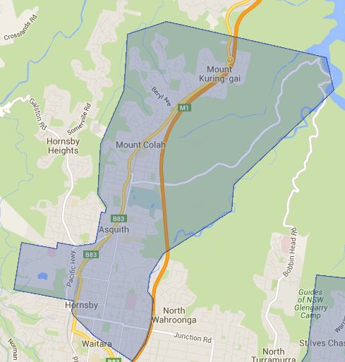
Added the St Ives High School catchment map and it is an interesting looking one. I was aware of that the system of mix of girls, boys and coed high school could play havoc on the catchment, but still was not prepared for the full scale of this. The catchment zone actually are significantly disconnected. I had a look at the surround high schools and there will be more of the same to come as well.

St Ives High School local drawing area

St Ives High School Catchment Local Drawing Area Map

St Ives High School northern drawing area

St Ives High School Catchment Northern Drawing Area Map

The most common name used by NSW Department of Education is called “catchment” which refer to that students resides in particular area are guaranteed position in specific schools. When discussed from prospective of a particular school is often referred as one of the following term.

  • School Zone
  • School intake area
  • School catchment

As usual contact the school in question or Department of Education for the final confirmation and you can also access the full High School Catchment Map by following this link.

Share this post:

Killarney Heights High School

This is the school catchment map for Killarney Heights High School in Sydney, NSW.

The most common name used by NSW Department of Education is called “catchment” which refer to that students resides in particular area are guaranteed position in specific schools. When discussed from prospective of a particular school is often referred as one of the following term.

  • School Zone
  • School intake area
  • School catchment

As usual contact the school in question or Department of Education for the final confirmation and you can also access the full High School Catchment Map by following this link.

Share this post:

Killara High School

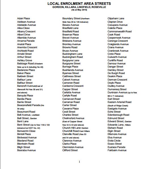
Had some personal issues I had to taken care of for last few days and finally able to get back to mapping again. Today I am doing the number one comprehensive high school in NSW which is Killara High School. This pretty much means translating three page of following into an actual map.

Killara High School Catchment Streetname

This map is accurate down to individual properties, as such information is provided in the street name list. I have adjusted the Chatswood High School map to match this more accurate information provided. A new high school is also scheduled to open in the old UTS Kuring-Gai site which means in 2019 the catchment will likely change significantly as result of this.

Note: The map is further updated again in Feb 2017 to match the catchment data with latest information.

The most common name used by NSW Department of Education is called “catchment” which refer to that students resides in particular area are guaranteed position in specific schools. When discussed from prospective of a particular school is often referred as one of the following term.

  • School Zone
  • School intake area
  • School catchment

As usual contact the school in question or Department of Education for the final confirmation and you can also access the full High School Catchment Map by following this link.

Share this post:

Chatswood High School Catchment Map and near future changes

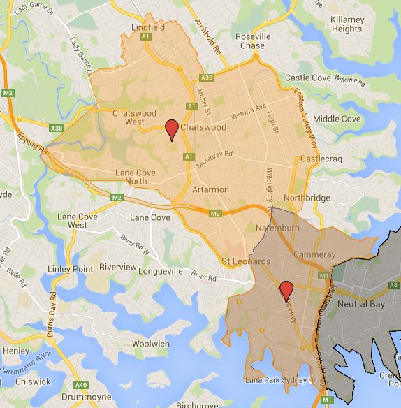
Did some more work today on the high school catchment and finished the Chatswood High School catchment map. What need to be noted is that the southern third of the current catchment has been sliced off and being passed off to the new Cammeraygal High School in stages. This start from Year 7 to 2015 and year 7 to 8 in 2016, then so on until the until southern section of the catchment gets handed off to the Cammeraygal High School. So depend on which year you are in your catchment may vary some until this transfer process is done completely.

A new high school based on old UTS Kuring-gai campus were scheduled to be opened in 2017, but this is now delayed until 2019 at earliest. When this opens expect large parts of northern section of Chatswood High School catchment to be handed off as well to the new high school. Two of this should help significantly the extreme crowding Chatswood High School currently being put under.

The most common name used by NSW Department of Education is called “catchment” which refer to that students resides in particular area are guaranteed position in specific schools. When discussed from prospective of a particular school is often referred as one of the following term.

  • School Zone
  • School intake area
  • School catchment

As usual contact the school in question or Department of Education for the final confirmation and you can also access the full High School Catchment Map by following this link.

Share this post:

First foray into mapping Sydney High School Catchment Map (Cammeraygal and Mosman High School)

Creating a catchment map for Sydney had been a highly requested by a lot of visitors of this site. I have been procrastinating a lot and keep putting off doing this. Now that we are pass new year and school had not started back up yet, I had more time than usual on my hand. So I figure I may as well get this started otherwise I would have absolutely no idea when I ever will get time to do this again.

The first set of update including one of Sydney newest high school Cammeraygal High School. This high school was opened in 2015 and created to relieve the extreme enrollment pressure the current public high schools are coming under in last decade. Cammeraygal High School took the first intake of year 7 in 2015, year 7 to 8 will be this year 2016, year 7 to 9 in 2017, year 7 to 10 in 2018, year 7 to 11 in 2019 and year 7 to 12 in 2020. During the ramp up period, higher years of students in the catchment goes to the Chatswood High School. For example with year 9 to 12 in 2016, the entire Cammeraygal High School catchment actually are part of Chatswood High School catchment.

Cammeraygal High School Catchment

Cammeraygal High School Catchment Map


Mosman High School Catchment

The most common name used by NSW Department of Education is called “catchment” which refer to that students resides in particular area are guaranteed position in specific schools. When discussed from prospective of a particular school is often referred as one of the following term.

  • School Zone
  • School intake area
  • School catchment

As usual contact the school in question or Department of Education for the final confirmation and you can also access the full High School Catchment Map by following this link.

Share this post:

Birrong, Chester North and Regents Park Public School Catchment Map Added

Slowly getting the center of the Sydney filled out, three more public school added.

  • Birrong Public School
  • Chester North Public School
  • Regents Park Public School

As usual contact the school in question or Department of Education for the final confirmation and you can also access the full NSW and Sydney Public School Catchment Map by following this link.

Share this post:

Artarmon Public School Part 2

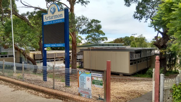
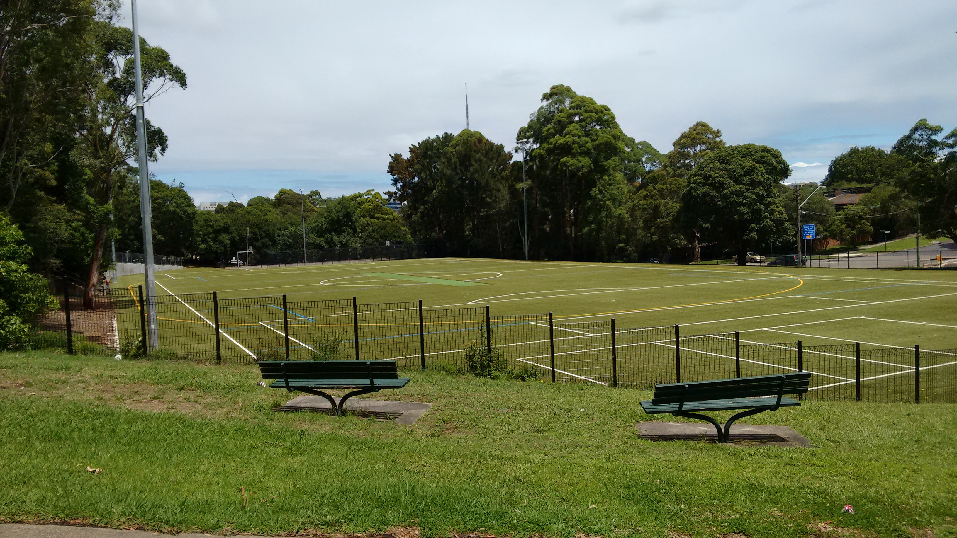
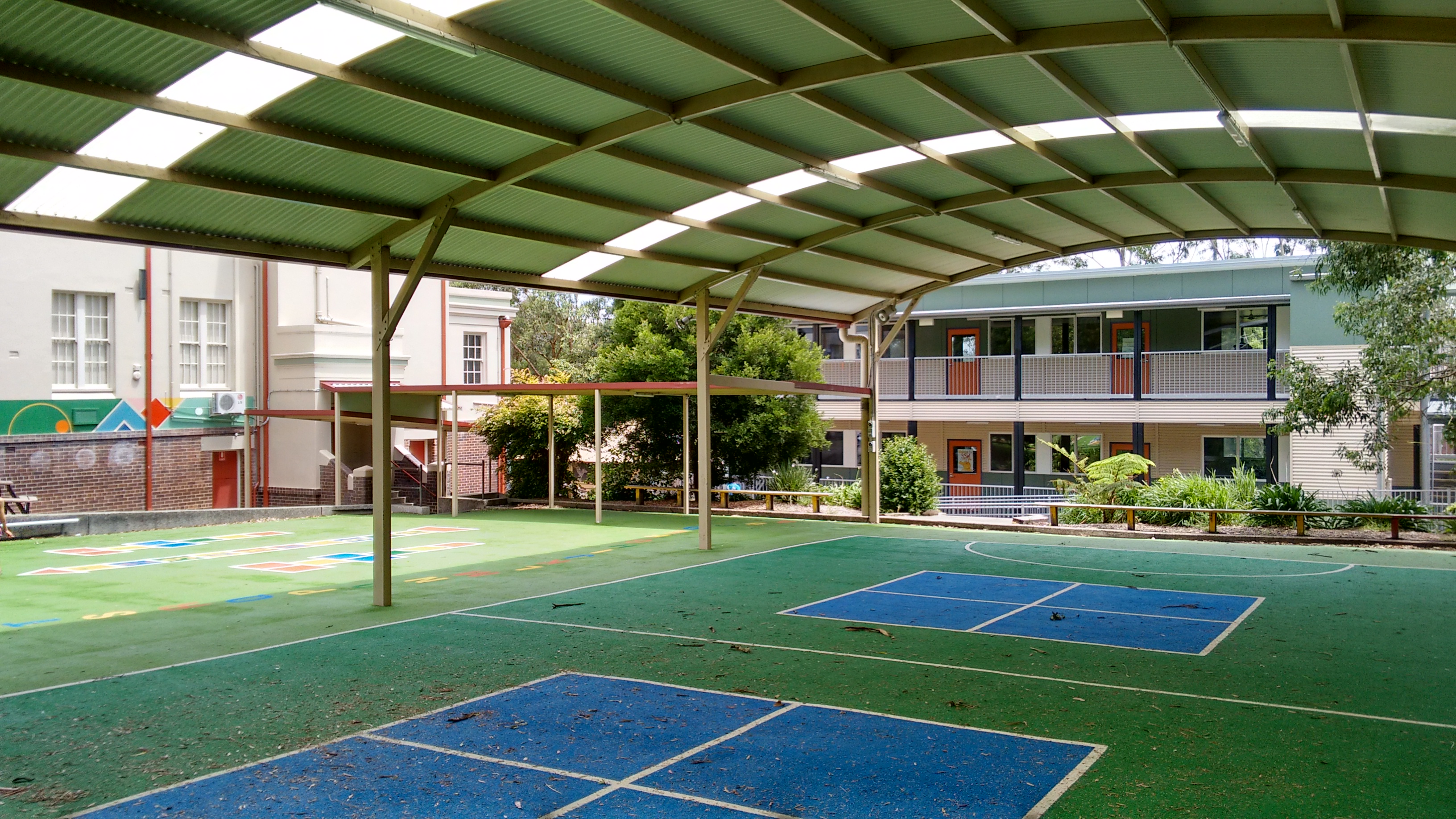
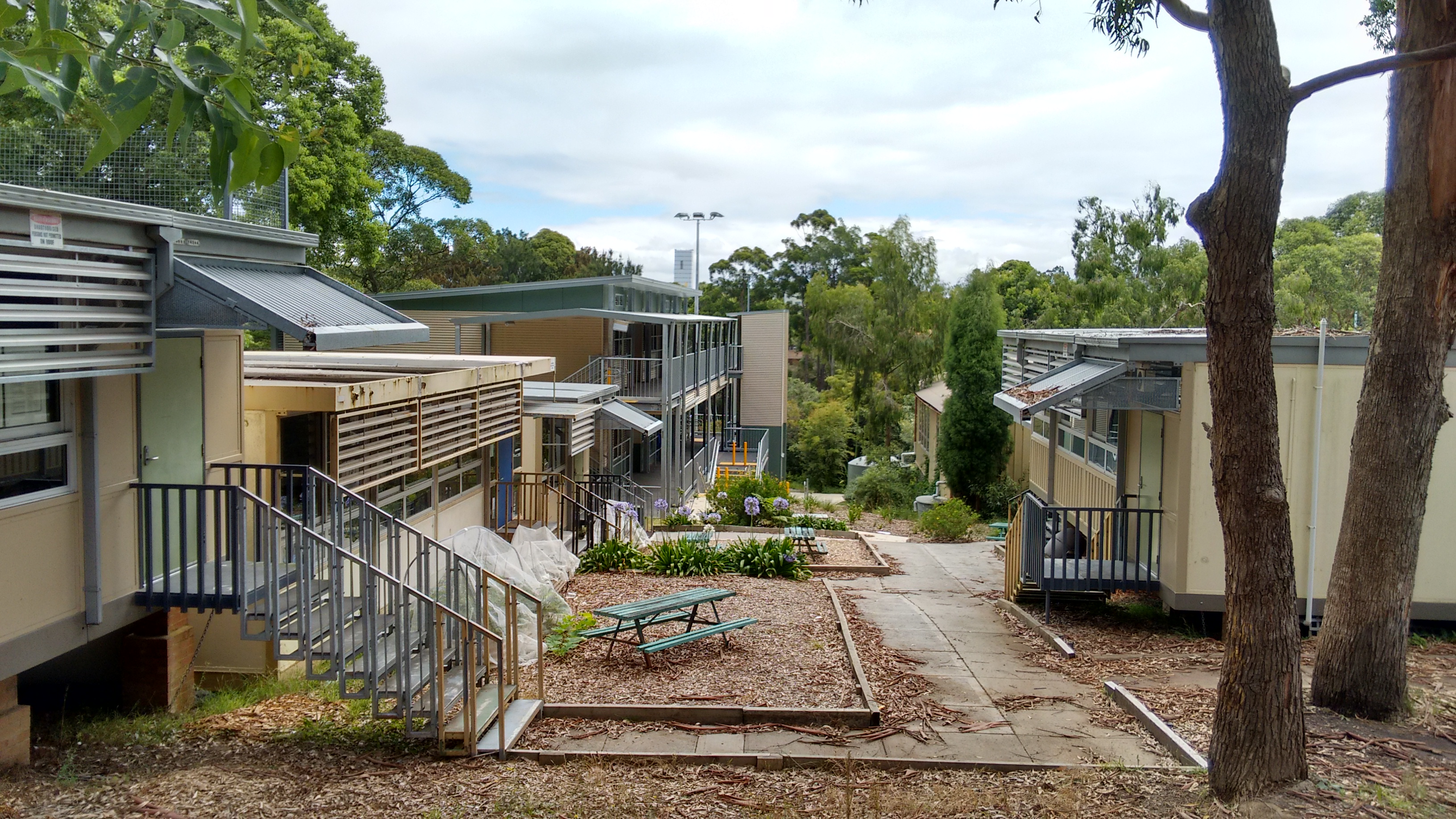
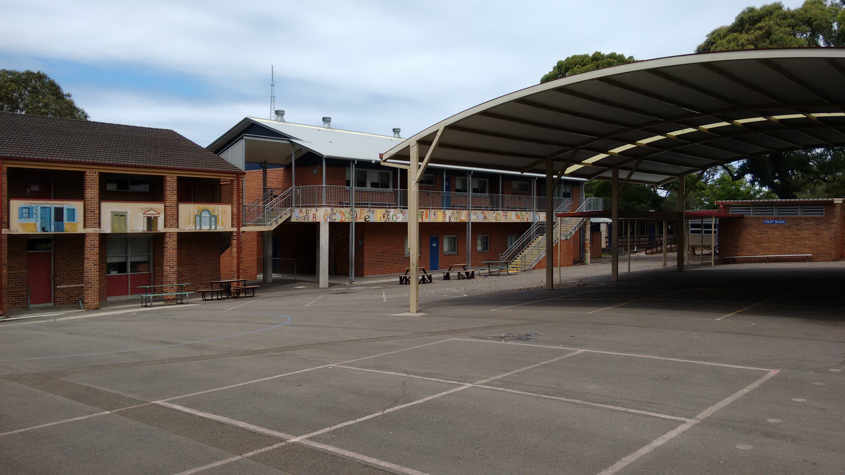
I have done an Introduction on Artarmon Public School a few month back. I wasn’t able to actually visit the actual school at the time. I was happens to be nearby on last Saturday, so I paid a visit. You know most of facts just by reading about it and looking at satellite map, however visiting it is still prove to be very interesting for me.

You really get a sense of the pressure the public schools in Sydney north shore area is currently under. Artarmon Public School is in the epicenter of this wave of increase in enrollment and there is no end in sight any time soon. Artarmon Public School is scheduled to receive a major upgrade by removing a lot of demountables and construct new multi level building to replace them.

So many demountables got put up, school itself has very limited open space. I counted fifteen demountables and semi permanent type of buildings contain roughly 17 classrooms.

IMG_20160116_140918584 IMG_20160116_141100566_HDR IMG_20160116_142431456_HDRIMG_20160116_141431319

Enjoyed the pictures and I certainly had a good time visiting the school.


Granville South, Guildford and Old Guildford Public School Catchment Map Added

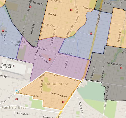
Three more schools and as further west I move less accurate the map becomes, it is actually to be able to find reliable and accurate public information for schools in Western Sydney. So if you do happens to have them please feel free to link or send it to me, you can either comment or contact me via the email found in the About us page.

  • Granville South Public School
  • Guildford Public School
  • Old Guildford Public School

The interconnecting boundaries between these three schools are pretty much pure guess and estimation, as usual contact the school in question or Department of Education for the final confirmation and you can also access the full NSW and Sydney Public School Catchment Map by following this link.

Share this post:


Blaxcell Street, Granville and Granville East Public School Catchment Map Added

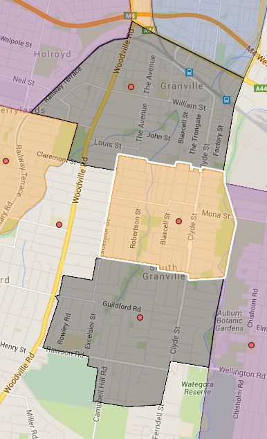
Three more public school catchment map added, I actually missed the Blaxcell Street Public School previously and was wondering the over large coverage of South Granville of existing public schools. With Blaxcell Street Public School added, the coverage looks more sense.

  • Blaxcell Street Public School
  • Granville Public School
  • Granville East Public School

Parts of Granville Public School’s southern border is very much a guess, so as usual contact the school in question or Department of Education for the final confirmation and you can also access the full NSW and Sydney Public School Catchment Map by following this link.

Share this post:

How to solve the problem that Motorola Android Phone and Tablet unable to Connect with the Computer as Camera or MTP device

This one is unrelated to my usual education topics, but I personally have spend hours if not days multiple times trying to resolve this issue with Motorola Android devices connecting to the computers as either, camera, MTP or ADP device. The problem started when I first acquired a Motorola Xoom tablet, one of the first usable Android tablet. No matter what I tried I could not connect to the Windows XP I was using at the time. I tried connect as ADP device, connect via debug mode, install Motorola USB drivers, plus just about everything that Google search can return, none worked. It is at end, finally some random forum mentioned that installing Media Center, so I installed that on Windows XP and everything just worked from that point.

I picked up a Motorola G 2nd Gen phone beginning of last year and it was a very solid phone for its price. I enjoyed the near vanilla experience and had no issue connecting to the Windows 7 that I was using at the time. Then after upgrading my computer and with the newly installed Windows 8, I had to go through this entire business again and problem is solved by installing Windows Media Feature which is no longer standard on Windows 8. Going on I have upgraded to Windows 10 at middle of the year which I loved so far, however I got the same problem back, so no issue since I know the solution already, just download and install the Windows Media Feature pack and problem solved.

Fast forward to November last year, suddenly that I could not connect the Motorola G 2nd Gen phone to the computer anymore. So I started going through the system and look like Windows update removed the Media Feature Pack, so I thought no issue, I will just do a Google search and install it again. So I clicked the first search result return in Google that in Microsoft installing Windows Media Feature Pack which download and install the Windows10-KB3010081-x64.msu.

To my surprise my trusty old fix no longer work again, so I went off on a tangent and wasted hours of my life going through the entire process again, trying and reinstalling various of drivers. Trying connect camera, MTP device and in debug mode etc, none worked. So I was pretty much back to the square one again. Without the abilities to connect the computer, my phone is close to being just a phone, so I persisted. Finally after more Google search I came across the solution, apparently the KB3010081 version of Window Media Feature Pack no longer compatible with my Windows 10 after the November update. So again after more Google searches, I found installing KB3099229_x64.msu and solved my connection issue.

So to summarise

First prepare by download and install the Motorola USB driver which is called Motorola Device Manager I believe in your system. Then carry out the following on your Windows version

  1. Widnows XP: Install Windows Media Center
  2. Widnows 7 and Vista: Windows Media Center is bundled and should just work
  3. Windows 8: Install Windows Media Feature Pack
  4. Windows 10: Should just work
  5. Windows 10N: You will have install Windows Media Feature Pack, please search and install KB3099229_x64.msu if you on November update or later.

I hope this save someone else some time, it literally wasted days of my life. Google searches does not return a straight forward answer for this issue and I only managed to solved the issue by piecing different things together.
en_AUEnglish (Australia)