New Schools Currently Being Constructed In NSW

It has been somewhat of a slow week for me and I thought it is a good idea to have a look at what new schools are currently being constructed in NSW.

Queanbeyan SSP (School for Special Purpose)
Forecast completion: Early 2021

Alexandria Park Community School
Forecast completion: Early 2022

Kyeemagh Public School
Forecast completion: Late 2021

Penshurst Public School
Forecast completion: Early 2021

Schools at the Meadowbank Education and Employment Precinct
Forecast completion: Late 2021

Marsden Park Public School
Forecast completion: Mid 2021

Galungara Public School (New school at Farmland Drive, Schofields)
Forecast completion: Early 2021

Leppington new primary school
Forecast completion: Late 2021

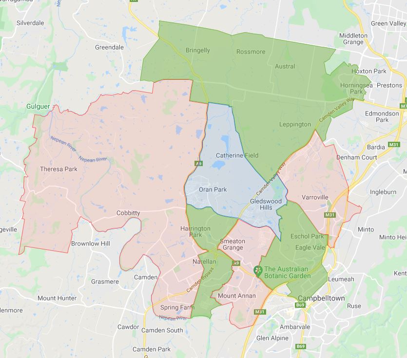
Catherine Field new primary school
Forecast completion: Late 2021

Picton High School
Forecast completion: Early 2022

This should give an idea of upcoming new schools in the next one to two years and invariable accompanying catchment changes as well.

新南威尔士州教育部最常用的名称是“catchment”。从特定学校的角度进行讨论时,通常被称为以下术语之一。

  • School Zone
  • School intake area
  • School catchment

与往常一样,我们建议您与有关学校或教育部联系,以获得相关信息的最终确认。 悉尼高中学区地图 通过点击此链接。

分享这个帖子:

Email This Post 通过电子邮件分享此帖

即将到来的2021年悉尼和新南威尔士州中学学区更新

This is a quick update on the changes to the catchment that will happen in 2021 for NSW and Sydney secondary schools.

主要的变化是由于新的悉尼Inner Sydney High School的启用,导致周围中学学区的变化。涉及的学校如下

  1. Inner Sydney High School
  2. Rose Bay Secondary College
  3. Randwick Boys High School
  4. Randwick Girls High School
  5. Alexandria Park Community School
  6. Sydney Secondary College Balmain
  7. Sydney Secondary College Leichhardt
  8. Sydney Secondary College Blackwattle Bay

七年级

十一年级

The next group is located in south-western Sydney and the changes are due to the new Oran Park High School. Changes will be applying to the following schools.

  1. Oran Park High School
  2. John Edmondson High School
  3. Robert Townson High School
  4. Eagle Vale High School
  5. Mt Annan High School
  6. Elizabeth Macarthur High School
  7. Elderslie High School

The most common name used by the NSW Department of Education is called “catchment” which refers to those students who reside in a particular area who are guaranteed a position in specific schools. When discussed from the perspective of a particular school is often referred to as one of the following terms.

  • School Zone
  • School intake area
  • School catchment

As usual, contact the school in question or the Department of Education for the final confirmation and you can also access the full 悉尼高中学区地图 通过点击此链接。

分享这个帖子:

Email This Post 通过电子邮件分享此帖

Inner Sydney High School

This is the school catchment map for Inner Sydney High School in Sydney, NSW.

The most common name used by the NSW Department of Education is called “catchment” which refer to that students resides in a particular area are guaranteed position in specific schools. When discussed from the perspective of a particular school is often referred to as one of the following terms.

  • School Zone
  • School intake area
  • School catchment

As usual contact the school in question or Department of Education for the final confirmation and you can also access the full High School Catchment Map 通过点击此链接。

分享这个帖子:

Email This Post 通过电子邮件分享此帖

2020 NSW, Sydney High School Year 11 Catchment Map Update

The High school zone map has been updated for the entire state of NSW for 2020.

Sydney High School Catchment Map for Year 11

NSW/Sydney High School Catchment Map for Year 7 to 10

新南威尔士州教育部最常用的名称是“catchment”。从特定学校的角度进行讨论时,通常被称为以下术语之一。

  • School Zone
  • School intake area
  • School catchment

As usual contact the school in question or Department of Education for the final confirmation and you can also access the full 悉尼高中学区地图 通过点击此链接。

分享这个帖子:

Email This Post 通过电子邮件分享此帖

2020 NSW, Sydney High School Year 7 Catchment Map Update

The High school zone map has been updated for the entire state of NSW for 2020.

Sydney High School Catchment Map for Year 7

NSW/Sydney High School Catchment Map for Year 7 to 10

新南威尔士州教育部最常用的名称是“catchment”。从特定学校的角度进行讨论时,通常被称为以下术语之一。

  • School Zone
  • School intake area
  • School catchment

As usual contact the school in question or Department of Education for the final confirmation and you can also access the full 悉尼高中学区地图 通过点击此链接。

分享这个帖子:

Email This Post 通过电子邮件分享此帖

Changes to Sydney/NSW Secondary School Catchment for 2019

I went over the high school catchment zone for Sydney in the last few days. Following are the changes and update to 2019 Sydney/NSW secondary school catchment updates.

  • First and not the last I have corrected some spelling mistakes in the previous map which is my bad.
  • Glenwood high school expansion to the north pretty much doubled its current catchment. This overlaps with new The Ponds High School catchment. Looking at the information available, the overlapping shaded area should cease to exist in 2019 from what I understand. However, there is still overlapping area, so as usual, I recommend contacting the school in question for the final confirmation.
  • Riverstone High School covers the western part of The Ponds High School. My understanding is that same as Glenwood High School, the overlaid part of the catchment is meant to exclusively belong to The Ponds High School, however, the official information still indicates otherwise. So I would still highly recommend contacting the school in question as well in this case.
  • Wyndham College shows it covers what is part of The Ponds High School as well. The Ponds High School catchment is supposed to be exclusive from 1st of January 2019 so I would suggest contacting the school in question for final confirmation as above.
  • Chifley College Dunheved Campus expanded to the southeastern corner now covering most of the suburb of Whalan.
  • Beverly Hills Girls High School big expansion to the east it now covers most of Roseland and Beverly Hills.
  • Mini-expansion of Casula high school to the western tip covering a small patch of what previously was no man land. Plus small expansion to the southern edge taking over parts of what used to be part of Ingleburn High School, this is mostly no man’s land as well.
  • Ingleburn High School loses most of the northern part over the railway, most of those do not look to be residential, so catchment wise that is really not much of a change.
  • John Edmondson High School lost the southwestern corner west of Deepfields road to Mount Annan High School, relative to the existing its existing catchment, it is a fairly minor change.
  • Mount Annan High School huge expansion to the north of Camden valley way, this almost double the size of the existing catchment. The added part is not as populated compared to the existing zone, but this is still a very significant expansion. The expansion corresponds to the shrinking of
    Elizabeth Macarthur High School and
  • Elizabeth Macarthur High School catchment also shrinks very significantly, it lost part that is north-west of Camden Valley way and The northern road to Elderslie High School. It also lost the northeastern section over Oran park drive to Mount Annan High School.
  • As previously discussed Elderslie High School gained towards east all the way until The northern road.

The most common name used by the NSW Department of Education is called “catchment” which refer to that students resides in a particular area are guaranteed a position in specific schools. When discussed from the perspective of a particular school is often referred to as one of the following terms.

  • School Zone
  • School intake area
  • School catchment

As usual contact the school in question or Department of Education for the final confirmation and you can also access the full 悉尼高中学区地图 通过点击此链接。

分享这个帖子:

Email This Post 通过电子邮件分享此帖

Cecil Hills High School

This is the school catchment map for Cecil Hills High School in Sydney, NSW.

The full map which you will need to zoom down or use the search function to find the school you want to look at.

The most common name used by NSW Department of Education is called “catchment” which refer to that students resides in particular area are guaranteed a position in specific schools. When discussed from the perspective of a particular school is often referred as one of the following terms.

  • School Zone
  • School intake area
  • School catchment

As the usual contact, the school in question or Department of Education for the final confirmation and you can also access the full High School Catchment Map 通过点击此链接。

分享这个帖子:

Full Sydney High School Year 7 to 10 Catchment Map Completed

I have been working on this in the last few weeks and have now completed it. The full map can be found as following, in addition to the ones that has been completed previously, about 100 new school zones are being added now.

  • Airds High School
  • Ambarvale High School
  • Arthur Phillip High School
  • Ashcroft High School
  • Asquith Boys and Girls High School
  • Auburn Girls High School
  • Bankstown Girls High School
  • Bass High School
  • Belmore Boys and Wiley Park Girls High School
  • Beverly Hills Girls High School
  • Birrong Boys and Girls High School
  • Blacktown Boys and Girls High School
  • Blaxland High School
  • Bonnyrigg High School
  • Bossley Park High School
  • Cabramatta High School
  • Cambridge Park High School
  • Camden High School
  • Camden High School
  • Campbelltown Performing Arts High School
  • Canley Vale High School
  • Casula High School
  • Cecil Hills High School
  • Cheltenham Girls High School
  • Chester Hill High School
  • Chifley College Bidwill Campus
  • Chifley College Dunheved Campus
  • Chifley College Mount Druitt Campus
  • Chifley College Shalvey Campus
  • Colo High School
  • Colyton High School
  • Condell Park High School
  • Cranebrook High School
  • Doonside High School
  • Eagle Vale High School
  • East Hills Boys High School and Easter Hills Girls Technology High School
  • Elderslie High School
  • Elizabeth Macarthur High School
  • Epping Boys High School
  • Erskine Park High School
  • Evans High School
  • Fairfield High School
  • Fairvale High School
  • Frenchs Forest Public School
  • Galston High School
  • Glenmore Park High School
  • Granville Boys High School
  • Granville South Creative and Performing Arts High School
  • Greystanes High School
  • Hawkesbury High School
  • Holroyd High School
  • Holsworthy High School
  • Hoxton Park High School
  • Ingleburn High School
  • James Busby High School
  • James Meehan High School
  • Jamison High School
  • John Edmondson High School
  • Kingsgrove North High School
  • Kingswood High School
  • Leumeah High School
  • Liverpool Boys and Girls High School
  • Lurnea High School
  • Macarthur Girls High School
  • Macquarie Fields High School
  • Merrylands High School
  • Miller High School
  • Mitchell High School
  • Moorebank High School
  • Mount Annan High School
  • Nepean Creative and Performing Arts High School
  • Northern Beaches Secondary College Balgowlah Boys and Mackellar Girls Campus
  • Northern Beaches Secondary College Cromer Campus
  • Pendle Hill High School
  • Picnic Point High School
  • Plumpton High School
  • Prairiewood High School
  • Punchbowl Boys High School
  • Quakers Hill High School
  • Richmond High School
  • Riverside Girls High School
  • Riverstone High School
  • Robert Townson High School
  • Rooty Hill High School
  • Sarah Redfern High School
  • Sefton High School
  • Seven Hills High School
  • Sir Joseph Banks High School
  • St Clair High School
  • St Johns Park High School
  • The Hills Sports High School
  • Thomas Reddall High School
  • Westfields Sports High School
  • Willoughby Girls High School
  • Windsor High School

The most common name used by NSW Department of Education is called “catchment” which refer to that students resides in particular area are guaranteed position in specific schools. When discussed from prospective of a particular school is often referred as one of the following term.

  • School Zone
  • School intake area
  • School catchment

As usual contact the school in question or Department of Education for the final confirmation and you can also access the full 悉尼高中学区地图 通过点击此链接。

分享这个帖子:

Cammeraygal High School

This is the school catchment map for Cammeraygal High School in Sydney, NSW. You can search for a particular school or address in the search box in the top right-hand corner of the embedded map or zoom into an area of interest on the map.

For ease of viewing, I have also added a screen capture of the school zone as of 2019.10.12.

Cammeraygal High School Catchment Map
Cammeraygal High School Catchment Zone Map

The most common name used by NSW Department of Education is called “catchment” which refer to that students resides in particular area are guaranteed position in specific schools. When discussed from prospective of a particular school is often referred as one of the following term.

  • School Zone
  • School intake area
  • School catchment

As usual contact the school in question or Department of Education for the final confirmation and you can also access the full High School Catchment Map 通过点击此链接。

分享这个帖子:

NSW/Sydney High School Catchment Map for Year 7 to 10

This is NSW/Sydney High School Catchment Map for Year 7 to 10.

The most common name used by NSW Department of Education is called “catchment” which refer to that students resides in particular area are guaranteed position in specific schools. When discussed from prospective of a particular school is often referred as one of the following term.

  • School Zone
  • School intake area
  • School catchment

As usual contact the school in question or Department of Education for the final confirmation and you can also access the full 悉尼高中学区地图 通过点击此链接。

分享这个帖子:

zh_CN简体中文