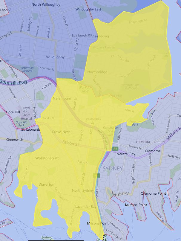
This is the school catchment map for Cammeraygal High School in Sydney, NSW. You can search for a particular school or address in the search box in the top right-hand corner of the embedded map or zoom into an area of interest on the map.
For ease of viewing, I have also added a screen capture of the school zone as of 2019.10.12.
The most common name used by NSW Department of Education is called “catchment” which refer to that students resides in particular area are guaranteed position in specific schools. When discussed from prospective of a particular school is often referred as one of the following term.
- School Zone
- School intake area
- School catchment
As usual contact the school in question or Department of Education for the final confirmation and you can also access the full High School Catchment Map 通过点击此链接。
分享这个帖子:
I have to shift to Crows nest. What is the catchment area of Cammeraygal High School
Hi,
I have added an additional explanation on how to search the map in question. Also, I have put in a screenshot to more easily show the school catchment as 2019.10.12 for ease of viewing.