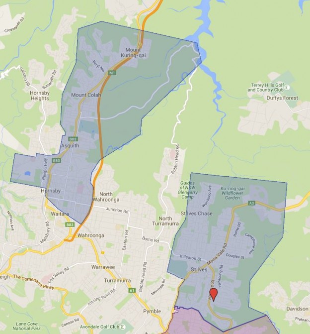
Added the St Ives High School catchment map and it is an interesting looking one. I was aware of that the system of mix of girls, boys and coed high school could play havoc on the catchment, but still was not prepared for the full scale of this. The catchment zone actually are significantly disconnected. I had a look at the surround high schools and there will be more of the same to come as well.
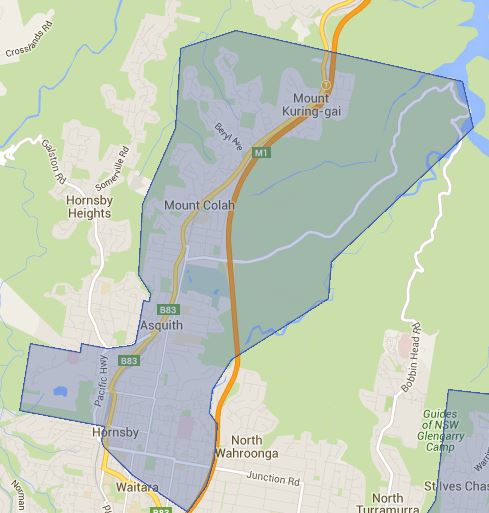
St Ives High School local drawing area
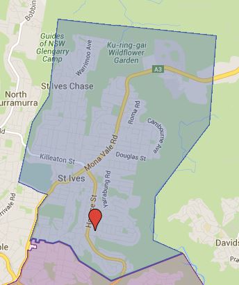
St Ives High School northern drawing area
The most common name used by NSW Department of Education is called “catchment” which refer to that students resides in particular area are guaranteed position in specific schools. When discussed from prospective of a particular school is often referred as one of the following term.
- School Zone
- School intake area
- School catchment
As usual contact the school in question or Department of Education for the final confirmation and you can also access the full High School Catchment Map 通过点击此链接。
分享这个帖子: