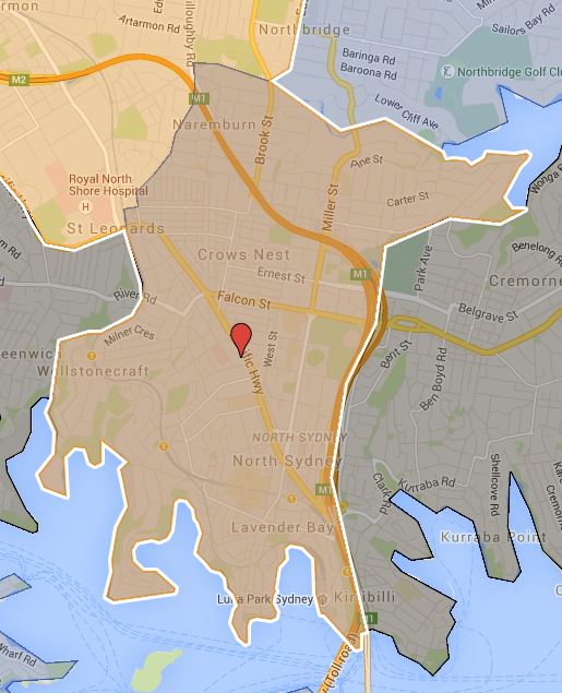
Killara High School

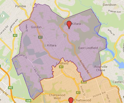
Had some personal issues I had to taken care of for last few days and finally able to get back to mapping again. Today I am doing the number one comprehensive high school in NSW which is Killara High School. This pretty much means translating three page of following into an actual map.
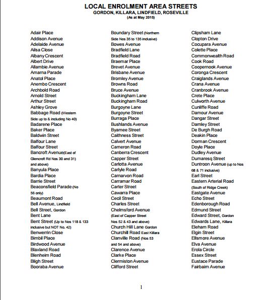
Killara High School Catchment Streetname

This map is accurate down to individual properties, as such information is provided in the street name list. I have adjusted the Chatswood High School map to match this more accurate information provided. A new high school is also scheduled to open in the old UTS Kuring-Gai site which means in 2019 the catchment will likely change significantly as result of this.

Note: The map is further updated again in Feb 2017 to match the catchment data with latest information.

The most common name used by NSW Department of Education is called “catchment” which refer to that students resides in particular area are guaranteed position in specific schools. When discussed from prospective of a particular school is often referred as one of the following term.

  • School Zone
  • School intake area
  • School catchment

As usual contact the school in question or Department of Education for the final confirmation and you can also access the full High School Catchment Map by following this link.

Share this post:
Chatswood High School Catchment Map and near future changes

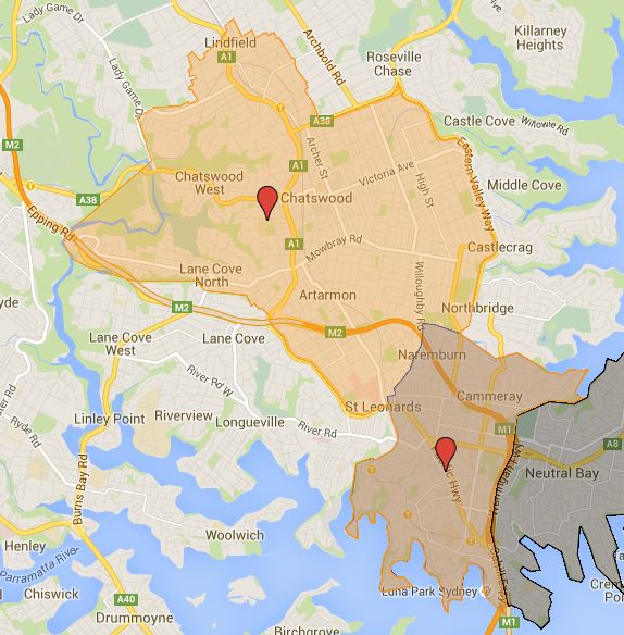
Did some more work today on the high school catchment and finished the Chatswood High School catchment map. What need to be noted is that the southern third of the current catchment has been sliced off and being passed off to the new Cammeraygal High School in stages. This start from Year 7 to 2015 and year 7 to 8 in 2016, then so on until the until southern section of the catchment gets handed off to the Cammeraygal High School. So depend on which year you are in your catchment may vary some until this transfer process is done completely.

A new high school based on old UTS Kuring-gai campus were scheduled to be opened in 2017, but this is now delayed until 2019 at earliest. When this opens expect large parts of northern section of Chatswood High School catchment to be handed off as well to the new high school. Two of this should help significantly the extreme crowding Chatswood High School currently being put under.

The most common name used by NSW Department of Education is called “catchment” which refer to that students resides in particular area are guaranteed position in specific schools. When discussed from prospective of a particular school is often referred as one of the following term.

  • School Zone
  • School intake area
  • School catchment

As usual contact the school in question or Department of Education for the final confirmation and you can also access the full High School Catchment Map by following this link.

Share this post:
First foray into mapping Sydney High School Catchment Map (Cammeraygal and Mosman High School)

Creating a catchment map for Sydney had been a highly requested by a lot of visitors of this site. I have been procrastinating a lot and keep putting off doing this. Now that we are pass new year and school had not started back up yet, I had more time than usual on my hand. So I figure I may as well get this started otherwise I would have absolutely no idea when I ever will get time to do this again.

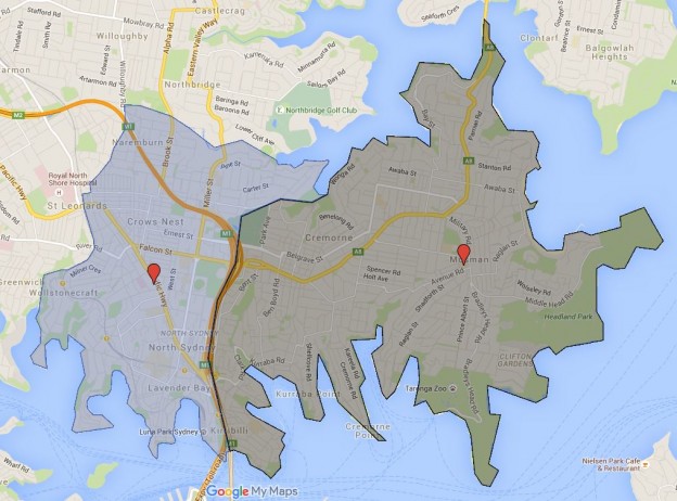
The first set of update including one of Sydney newest high school Cammeraygal High School. This high school was opened in 2015 and created to relieve the extreme enrollment pressure the current public high schools are coming under in last decade. Cammeraygal High School took the first intake of year 7 in 2015, year 7 to 8 will be this year 2016, year 7 to 9 in 2017, year 7 to 10 in 2018, year 7 to 11 in 2019 and year 7 to 12 in 2020. During the ramp up period, higher years of students in the catchment goes to the Chatswood High School. For example with year 9 to 12 in 2016, the entire Cammeraygal High School catchment actually are part of Chatswood High School catchment.

Cammeraygal High School Catchment

Cammeraygal High School Catchment Map


Mosman High School Catchment

The most common name used by NSW Department of Education is called “catchment” which refer to that students resides in particular area are guaranteed position in specific schools. When discussed from prospective of a particular school is often referred as one of the following term.

  • School Zone
  • School intake area
  • School catchment

As usual contact the school in question or Department of Education for the final confirmation and you can also access the full High School Catchment Map by following this link.

Share this post:
en_AUEnglish (Australia)