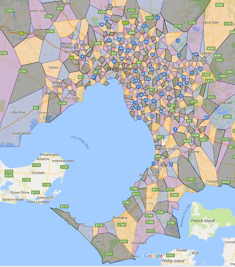
This page contains the individual school zone map for all of Melbourne’s primary schools. This page will go through very major changes including changes to existing maps and many additional new ones.
Victoria, Melbourne Primary School Zone Map
A
- Abbotsford Primary School
- Aberfeldie Primary School
- Ainslie Parklands Primary School
- Aitken Creek Primary School
- Aitken Hill Primary School
- Alamanda K-9 College (Primary)
- Albanvale Primary School
- Albany Rise Primary School
- Albert Park Primary School
- Albion North Primary School
- Albion Primary School
- Aldercourt Primary School
- Alphington Primary School
- Altona Green Primary School
- Altona Meadows Primary School
- Altona North Primary School
- Altona P-9 College (Primary)
- Altona Primary School
- Amsleigh Park Primary School
- Andersons Creek Primary School
- Antonio Park Primary School
- Apollo Parkways Primary School
- Ardeer Primary School
- Ardeer South Primary School
- Armadale Primary School
- Arnold’s Creek Primary School (interim name)
- Arthurs Creek Primary School
- Ascot Vale Primary School
- Ascot Vale West Primary School
- Ashburton Primary School
- Ashley Park Primary School
- Aspendale Gardens Primary School
- Aspendale Primary School
- Athol Road Primary School
- Auburn Primary School
- Auburn South Primary School
- Avondale Primary School
B
- Baden Powell P-9 College (Derrimut Heath Campus) (Primary)
- Balliang East Primary School
- Balnarring Primary School
- Balwyn North Primary School
- Balwyn Primary School
- Baden Powell P-9 College (Tarneit Campus) (Primary Level)
- Badger Creek Primary School
- Ballam Park Primary School
- Banyan Fields Primary School
- Banyule Primary School
- Barton Primary School
- Bayside P-12 College (Altona North Campus) (Primary)
- Bayswater North Primary School
- Bayswater Primary School
- Bayswater South Primary School
- Bayswater West Primary School
- Beaconsfield Primary School
- Beaconsfield Upper Primary School
- Beaumaris North Primary School
- Beaumaris Primary School
- Belgrave South Primary School
- Bell Primary School
- Bellbridge Primary School
- Belle Vue Park Primary School
- Belle Vue Primary School
- Belvedere Park Primary School
- Bentleigh West Primary School
- Benton Junior College
- Berwick Chase Primary School
- Berwick Fields Primary School
- Berwick Lodge Primary School
- Berwick Primary School
- Bethal Primary School
- Beverley Hills Primary School
- Billanook Primary School
- Bimbadeen Heights Primary School
- Birmingham Primary School
- Birralee Primary School
- Bittern Primary School
- Black Rock Primary School
- Blackburn Lake Primary School
- Blackburn Primary School
- Bonbeach Primary School
- Boneo Primary School
- Boronia Heights Primary School
- Boronia K-12 College (Rangeview Campus) (Primary)
- Boronia West Primary School
- Boroondara Park Primary School
- Box Hill North Primary School
- Brandon Park Primary School
- Brentwood Park Primary School
- Briar Hill Primary School
- Bridgewood Primary School
- Brighton Beach Primary School
- Brighton Primary School
- Broadmeadows Primary School
- Broadmeadows Valley Primary School
- Brookside P-9 College (Primary)
- Brunswick East Primary School
- Brunswick North Primary School
- Brunswick North West Primary School
- Brunswick South Primary School
- Brunswick South West Primary School
- Bundoora Primary School
- Burnside Primary School
- Burwood East Primary School
- Burwood Heights Primary School
C
- Cardinia Primary School
- Cairnlea Park Primary School
- Camberwell Primary School
- Camberwell South Primary School
- Cambridge Primary School
- Camelot Rise Primary School
- Campbellfield Heights Primary School
- Canterbury Primary School
- Carlton Gardens Primary School
- Carlton North Primary School
- Carlton Primary School
- Carnegie Primary School
- Carranballac P-9 College (Boardwalk Campus) (Primary)
- Carranballac P-9 College (Jamieson Way Campus) (Primary)
- Carrington Primary School
- Carrum Primary School
- Carwatha College P-12 (Primary)
- Caulfield Primary School
- Caulfield Junior College
- Caulfield South Primary School
- Chalcot Lodge Primary School
- Chandler Park Primary School
- Charles La Trobe P-12 College (La Trobe Campus) (Primary)
- Charles La Trobe P-12 College (Olympic Village Primary Campus) (Primary)
- Chatham Primary School
- Chelsea Heights Primary School
- Chelsea Primary School
- Cheltenham East Primary School
- Cheltenham Primary School
- Chirnside Park Primary School
- Christmas Hills Primary School
- Chum Creek Primary School
- Clarinda Primary School
- Clayton North Primary School
- Clayton South Primary School
- Clyde Primary School
- Coatesville Primary School
- Coburg North Primary School
- Coburg Primary School
- Coburg West Primary School
- Coburn Primary School
- Cockatoo Primary School
- Coldstream Primary School
- Collingwood College (Primary)
- Coolaroo South Primary School
- Coral Park Primary School
- Courtenay Gardens Primary School
- Craigieburn Primary School
- Craigieburn South Primary School
- Cranbourne Carlisle Primary School
- Cranbourne East Primary School
- Cranbourne Park Primary School
- Cranbourne Primary School
- Cranbourne South Primary School
- Cranbourne West Primary School
- Creekside K-9 College (Primary)
- Crib Point Primary School
- Croydon Hills Primary School
- Croydon Primary School
D
- Dallas Brooks Community Primary School
- Dandenong North Primary School
- Dandenong Primary School
- Dandenong South Primary School
- Dandenong West Primary School
- Darley Primary School
- Debney Meadows Primary School
- Deepdene Primary School
- Deer Park North Primary School
- Deer Park West Primary School
- Derinya Primary School
- Derrimut Primary School
- Devon Meadows Primary School
- Diamond Creek East Primary School
- Diamond Creek Primary School
- Dingley Primary School
- Dinjerra Primary School
- Dixons Creek Primary School
- Dohertys Creek P-9 College (Primary)
- Donburn Primary School
- Doncaster Gardens Primary School
- Doncaster Primary School
- Donvale Primary School
- Doreen Primary School
- Dorset Primary School
- Doveton College (Primary)
- Dromana Primary School
E
- East Bentleigh Primary School
- Eastbourne Primary School
- Eastwood Primary School
- Edithvale Primary School
- Elsternwick Primary School
- Eltham East Primary School
- Eltham North Primary School
- Eltham Primary School
- Elwood Primary School
- Emerald Primary School
- Epping Primary School (Greenbrook Campus)
- Epping Primary School (High Street Campus)
- Epping Views Primary School
- Essendon North Primary School
- Essendon Primary School
- Essex Heights Primary School
- Exford Primary School
F
- Fairfield Primary School
- Fairhills Primary School
- Fawkner Primary School
- Featherbrook P-9 College (Primary)
- Ferntree Gully North Primary School
- Ferny Creek Primary School
- Findon Primary School
- Fitzroy North Primary School
- Fitzroy Primary School
- Fleetwood Primary School
- Flemington Primary School
- Footscray City Primary School
- Footscray North Primary School
- Footscray Primary School
- Footscray West Primary School
- Fountain Gate Primary School
- Frankston East Primary School
- Frankston Heights Primary School
- Frankston Primary School
G
- Gardenvale Primary School
- Gladstone Park Primary School
- Great Ryrie Primary School
- Greenvale Primary School
- Gladstone Views Primary School
- Gladesville Primary School
- Glen Huntly Primary School
- Glen Iris Primary School
- Glen Katherine Primary School
- Glen Waverley Primary School
- Glen Waverley South Primary School
- Glendal Primary School
- Glenferrie Primary School
- Glengala/Sunshine West Primary School
- Glenroy Central Primary School
- Glenroy West Primary School
- Goonawarra Primary School
- Greenhills Primary School
- Greythorn Primary School
- Gruyere Primary School
H
- Hallam Primary School
- Hampton Park Primary School
- Hampton Primary School
- Harkaway Primary School
- Harrisfield Primary School
- Hartwell Primary School
- Harvest Home Primary School
- Hastings Primary School
- Hawthorn Primary School
- Hawthorn West Primary School
- Hazel Glen College (primary)
- Healesville Primary School
- Heany Park Primary School
- Heatherhill Primary School
- Heathmont East Primary School
- Heidelberg Primary School
- Highvale Primary School
- Hillsmeade Primary School
- Hughesdale Primary School
- Huntingdale Primary School
- Hurstbridge Primary School
I
J
K
- Kalinda Primary School
- Kallista Primary School
- Kananook Primary School
- Kangaroo Ground Primary School
- Karingal Heights Primary School
- Karingal Primary School
- Karoo Primary School
- Keilor Heights Primary School
- Keilor Primary School
- Keilor Views Primary School
- Kensington Primary School
- Kent Park Primary School
- Kent Street Primary School
- Kerrimuir Primary School
- Kew East Primary School
- Kew Primary School
- Keysborough Primary School
- Kilberry Valley Primary School
- Killara Primary School
- Kilsyth Primary School
- Kings Park Primary School
- Kingsbury Primary School
- Kingsley Park Primary School
- Kingston Heath Primary School
- Kingsville Primary School
- Kingswood Primary School
- Kismet Park Primary School
- Knox Central Primary School
- Knox Gardens Primary School
- Knox Park Primary School
- Koo Wee Rup Primary School
- Kororoit Creek Primary School
- Kunyung Primary School
- Kurunjang Primary School
L
- Laburnum Primary School
- Lalor East Primary School
- Lalor Gardens Primary School
- Lalor North Primary School
- Lalor Primary School
- Langwarrin Park Primary School
- Langwarrin Primary School
- Laurimar Primary School
- Laverton P-12 College (Primary)
- Le Page Primary School
- Lilydale Primary School
- Lilydale West Primary School
- Livingstone Primary School
- Lloyd Street Primary School
- Lower Plenty Primary School
- Lynbrook Primary School
- Lyndale Greens Primary School
- Lyndhurst Primary School
M
- Macclesfield Primary School
- Mackellar Primary School
- Macleod College (Macleod High Campus) (Primary)
- Mahogany Rise Primary School
- Malvern Central School
- Malvern Primary School
- Malvern Valley Primary School
- Manchester Primary School
- Manor Lakes P-12 College (Primary)
- Manorvale Primary School
- Maramba Primary School
- Marlborough Primary School
- Mckinnon Primary School
- Meadow Heights Primary School
- Meadowglen Primary School
- Meadows Primary School
- Melton Primary School
- Melton South Primary School
- Melton West Primary School
- Mentone Park Primary School
- Mentone Primary School
- Menzies Creek Primary School
- Mernda Central P-12 College (Primary)
- Mernda Park Primary School
- Mernda Primary School
- Merri Creek Primary School
- Mickleham Primary School
- Middle Park Primary School
- Milgate Primary School
- Mill Park Heights Primary School
- Mill Park Primary School
- Mitcham Primary School
- Monbulk Primary School
- Monmia Primary School
- Mont Albert Primary School
- Montmorency Primary School
- Montmorency South Primary School
- Montrose Primary School
- Moomba Park Primary School
- Moonee Ponds Primary School
- Moonee Ponds West Primary School
- Moorabbin Primary School
- Moorooduc Primary School
- Mooroolbark East Primary School
- Morang South Primary School
- Mordialloc Beach Primary School
- Moreland Primary School
- Mornington Park Primary School
- Mornington Primary School
- Mossfiel Primary School
- Mossgiel Park Primary School
- Mount Dandenong Primary School
- Mount Eliza North Primary School
- Mount Eliza Primary School
- Mount Evelyn Primary School
- Mount Martha Primary School
- Mount Pleasant Road Nunawading Primary School
- Mount Ridley P-12 College (Primary)
- Mount View Primary School
- Mount Waverley Heights Primary School
- Mount Waverley North Primary School
- Mount Waverley Primary School
- Mountain Gate Primary School
- Movelle Primary School
- Mulgrave Primary School
- Mullum Primary School
- Murrumbeena Primary School
N
- Narre Warren North Primary School
- Narre Warren South P-12 College (Primary Level)
- Newbury Primary School
- Newlands Primary School
- Newport Gardens Primary School (Hobsons Bay Campus)
- Newport Lakes Primary School
- Niddrie Primary School
- Noble Park Primary School
- Norris Bank Primary School
- North Melbourne Primary School
- Northcote Primary School
O
- Oak Park Primary School
- Oakleigh Primary School
- Oakleigh South Primary School
- Oatlands Primary School
- Officer Primary School
- Old Orchard Primary School
- Olinda Primary School
- Orchard Grove Primary School
- Ormond Primary School
- Osborne Primary School
- Overport Primary School
P
- Pakenham Consolidated School
- Pakenham Hills Primary School
- Pakenham Lakeside Primary School
- Pakenham Springs Primary School
- Panton Hill Primary School
- Park Orchards Primary School
- Park Ridge Primary School
- Parkdale Primary School
- Parkhill Primary School
- Parkmore Primary School
- Parktone Primary School
- Parkwood Green Primary School
- Pascoe Vale North Primary School
- Pascoe Vale Primary School
- Pascoe Vale South Primary School
- Patterson Lakes Primary School
- Pearcedale Primary School
- Pembroke Primary School
- Penders Grove Primary School
- Pentland Primary School
- Pinewood Primary School
- Plenty Parklands Primary School
- Point Cook Prep – Year 9 College
- Port Melbourne Primary School
- Preston North East Primary School
- Preston Primary School
- Preston South Primary School
- Preston West Primary School
- Princes Hill Primary School
Q
R
- Rangebank Primary School
- Rangeview Primary School
- Red Hill Consolidated School
- Regency Park Primary School
- Research Primary School
- Reservoir East Primary School
- Reservoir Primary School
- Reservoir Views Primary School
- Reservoir West Primary School
- Richmond Primary School
- Richmond West Primary School
- Ringwood Heights Primary School
- Ringwood North Primary School
- Ripponlea Primary School
- River Gum Primary School
- Roberts McCubbin Primary School
- Rockbank Primary School
- Rolling Hills Primary School
- Rosanna Golf Links Primary School
- Rosanna Primary School
- Rosebud Primary School
- Rosewood Downs Primary School
- Rowellyn Park Primary School
- Rowville Primary School
- Roxburgh Homestead Primary School
- Roxburgh Park Primary School
- Roxburgh Rise Primary School
- Ruskin Park Primary School
- Rye Primary School
S
- Saltwater P-9 College (Primary)
- Sandringham East Primary School
- Sandringham Primary School
- Sassafras Primary School
- Scoresby Primary School
- Seabrook Primary School
- Seaford North Primary School
- Seaford Park Primary School
- Seaford Primary School
- Seaholme Primary School
- Selby Primary School
- Serpell Primary School
- Seville Primary School
- Sherbourne Primary School
- Sherbrooke Community School
- Silvan Primary School
- Silverton Primary School
- Skye Primary School
- Solway Primary School
- Somers Primary School
- Somerville Primary School
- Somerville Rise Primary School
- Sorrento Primary School
- South Melbourne Park Primary School
- South Melbourne Primary School
- South Yarra Primary School
- Southern Cross Primary School
- Southmoor Primary School
- Spensley Street Primary School
- Spotswood Primary School
- Spring Parks Primary School
- Spring Parks Primary School Valley Campus
- Springside P-9 College (Primary)
- Springvale Rise Primary School (Interim name) (Springvale Road Campus)
- Springvale Rise Primary School (Interim Name) (Wareham Street Campus)
- St Albans East Primary School
- St Albans Heights Primary School
- St Albans Meadows Primary School
- St Albans North Primary School
- St Albans Primary School
- St Andrews Primary School
- St Kilda Park Primary School
- St Kilda Primary School
- Stevensville Primary School
- Stonnington Primary School
- Strathaird Primary School
- Strathmore North Primary School
- Strathmore Primary School
- Streeton Primary School
- Sunbury Heights Primary School
- Sunbury Primary School
- Sunbury West Primary School
- Sunshine Harvester Primary School
- Sunshine Heights Primary School
- Sunshine North Primary School
- Sunshine Primary School
- Surrey Hills Primary School
- Sydenham – Hillside Primary School (Hillside Campus)
- Sydenham – Hillside Primary School (Sydenham Campus)
- Syndal South Primary School
T
- Tarneit P-9 College (Primary)
- Tarneit Rise Primary School
- Taylors Hill Primary School
- Taylors Lakes Primary School
- Tecoma Primary School
- Templestowe Heights Primary School
- Templestowe Park Primary School
- Templestowe Valley Primary School
- Templeton Primary School
- The Basin Primary School
- The Grange P-12 College
- The Lakes South Morang P-9 School (Primary Campus)
- The Patch Primary School
- Thomas Chirnside Primary School
- Thomas Mitchell Primary School
- Thomastown East Primary School
- Thomastown Meadows Primary School
- Thomastown Primary School
- Thomastown West Primary School
- Thornbury Primary School
- Timbarra P-9 College (Primary)
- Tinternvale Primary School
- Tooradin Primary School
- Toorak Primary School
- Tootgarook Primary School
- Truganina P-9 College (Primary)
- Truganina South Primary School
- Tucker Road Bentleigh Primary School
- Tullamarine Primary School
- Tulliallan Primary School
- Tyabb Primary School
- Tyabb Railway Station Primary School
U
- University Park Primary School
- Upper Ferntree Gully Primary School
- Upwey Primary School
- Upwey South Primary School
V
W
- Wales Street Primary School
- Wallarano Primary School
- Wallaroo Primary School
- Wandin North Primary School
- Wandin Yallock Primary School
- Wantirna Primary School
- Wantirna South Primary School
- Warrandyte Primary School
- Warranwood Primary School
- Watsonia Heights Primary School
- Watsonia North Primary School
- Watsonia Primary School
- Wattle Glen Primary School
- Wattle Park Primary School
- Wattle View Primary School
- Waverley Meadows Primary School
- Wedge Park Primary School
- Weeden Heights Primary School
- Wembley Primary School
- Werribee Primary School
- Westall Primary School
- Westbreen Primary School
- Westgarth Primary School
- Westgrove Primary School
- Westmeadows Primary School
- Wheelers Hill Primary School
- Whitehorse Primary School
- Wilandra Rise Primary School
- William Ruthven Primary School
- Williamstown North Primary School
- Williamstown Primary School
- Willmott Park Primary School
- Wonga Park Primary School
- Woodlands Primary School
- Woodville Primary School
- Wooranna Park Primary School
- Wyndham Park Primary School
- Wyndham Vale Primary School
X
Y
- Yarra Glen Primary School
- Yarra Primary School
- Yarra Road Primary School
- Yarraman Oaks Primary School
- Yarrambat Primary School
- Yarraville Primary School
- Yering Primary School
Z
The proper name used by the Victorian Department of Education is called “Designated neighbourhood school” which is what a particular address is zoned for a particular school. When discussed from the perspective of a particular school is often referred to as one of the following terms.
- Designated neighbourhood zone
- Designated neighbourhood boundary
- Neighbourhood zone
- School Zone
- School intake area
- School catchment
For the final confirmation please contact the school in question.
Share this post:
 Email This Post