Seven Hills North, The Meadows, Toongabbie and Vardys Public School Catchment Added

Moving alone the western line and north west Sydney as well and continue to fill out catchment maps for more public schools.

  • Seven Hills North Public School
  • The Meadows Public School
  • Toongabbie Public School
  • Vardys Public School

As usual contact the school in question or Department of Education for the final confirmation and you can also access the full NSW and Sydney Public School Catchment Map 通过点击此链接。

分享这个帖子:

Wentworthville, Pendle Hill, Beresford Road, Toongabbie East and Toongabbie West Public School Catchment Added

It is getting harder to plot the school catchment now as the most of low hanging fruits have been picked already. However that being said, here is some more love for the western Sydney again, five more public school catchment added to the map.

  • Beresford Road Public School
  • Pendle Hill Public School
  • Toongabbie East Public School
  • Toongabbie West Public School
  • Wentworthville Public School

As usual contact the school in question or Department of Education for the final confirmation and you can also access the full NSW and Sydney Public School Catchment Map 通过点击此链接。

分享这个帖子:

Five more catchment added to the map in Western Sydney, Girraween, Metalla Road, Ringrose, Parramatta West and Hilltop Road Public School

Some love for the western Sydney, five more catchment added to the map.

  • Girraween Public School
  • Metalla Road Public School
  • Ringrose Public School
  • Parramatta West Public School
  • Hilltop Road Public School

As usual contact the school in question or Department of Education for the final confirmation and you can also access the full NSW and Sydney Public School Catchment Map 通过点击此链接。

分享这个帖子:

Chatswood Public School

Chatswood public school was established in 1883 and is one of the oldest state schools in Sydney. The school’s logo is Latin word “Fortiter” which means strong or mighty in English. In 2014 there were 957 students enrolled in the school and that is an increase of 40% since 2008, this is very common in the north shore area. As a result, the school is extremely over capacity like many of the top state public school in Sydney.

In 2014 students with a language background other than English sits at 80 per cent, this number is really high for public schools in northern Sydney suburbs. It also hosts opportunity classes for year 5 to 6. Chatswood public school has an excellent academic reputation with 50% of Year 6 students accessing Selective High Schools according to the school website.

2010201120122013
Ranking19143914

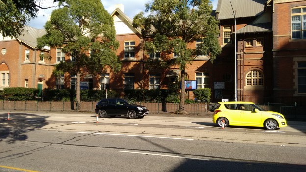
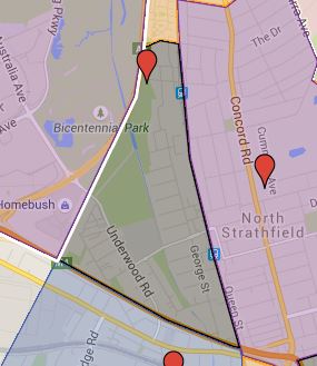
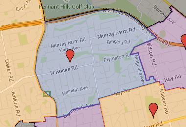
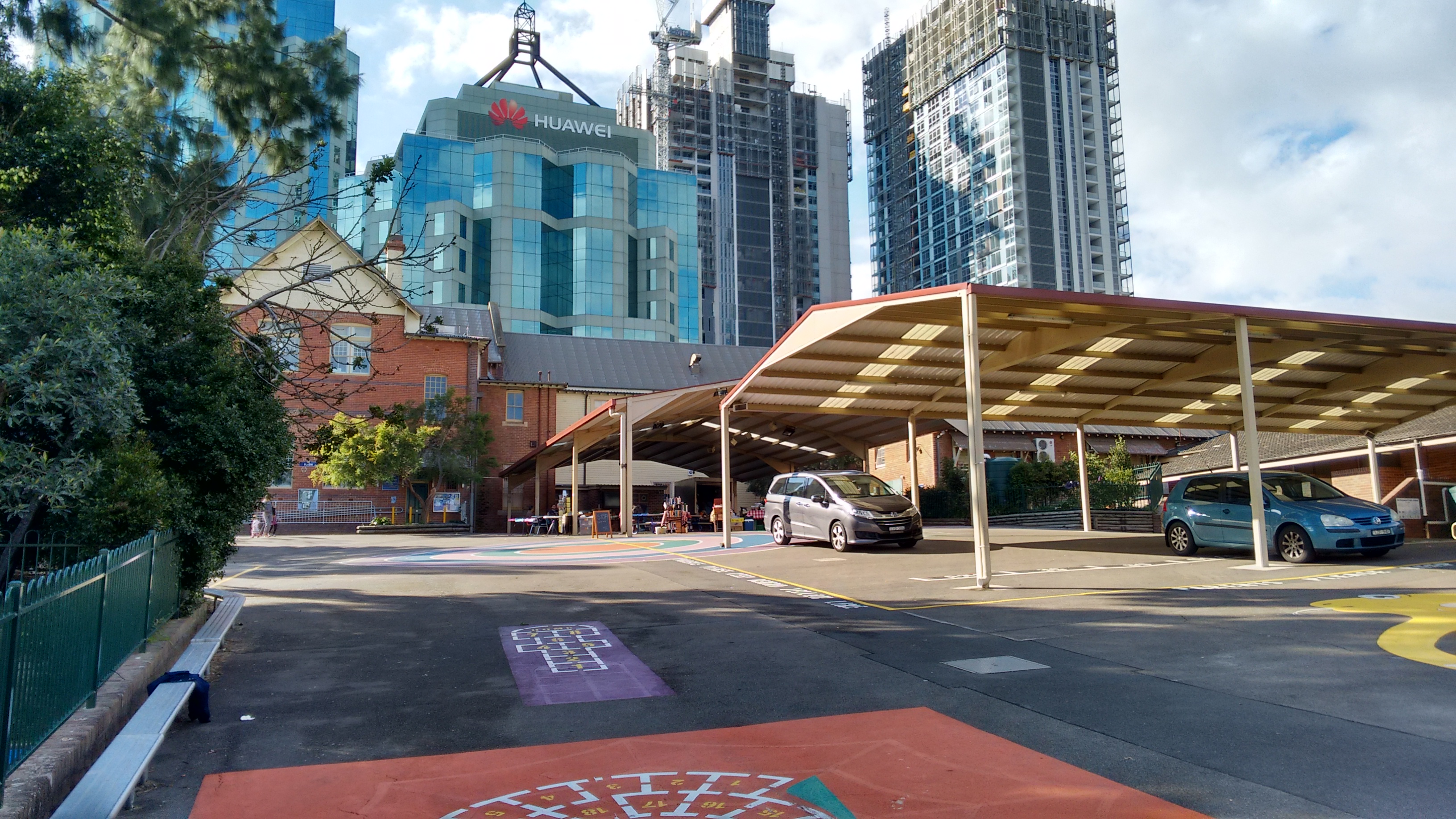
The geography of the north shore suburb is naturally divided by the Pacific high way; the land is relatively flat to the east and often falls off with a fairly steep to the west of it. Chatswood public school is very much the case, the east of school sits next to the Pacific high way and fall fairly steeply to the west. You can easily see that in the following images.

IMG_20150606_102301069

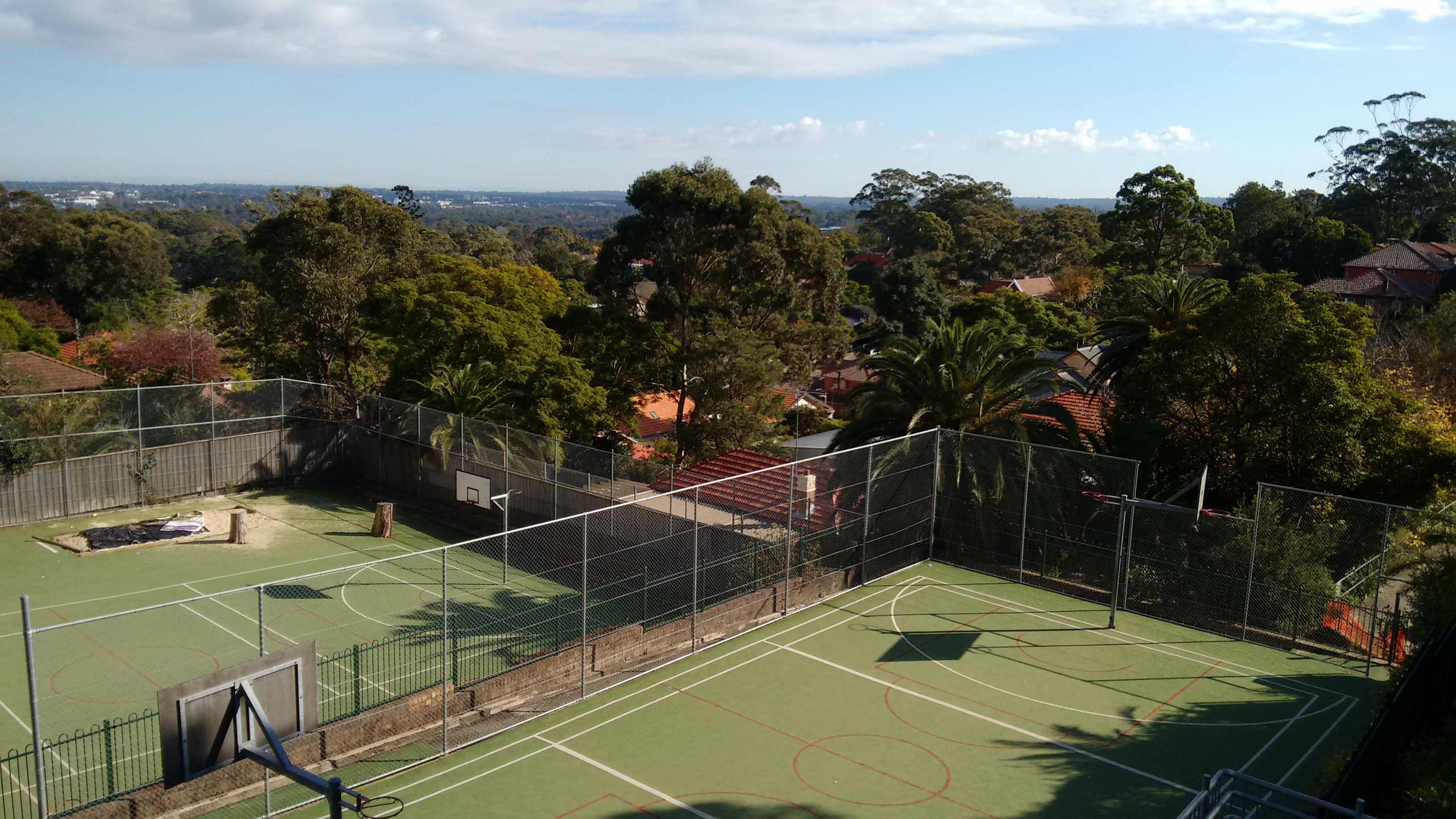
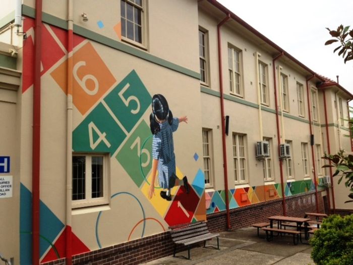
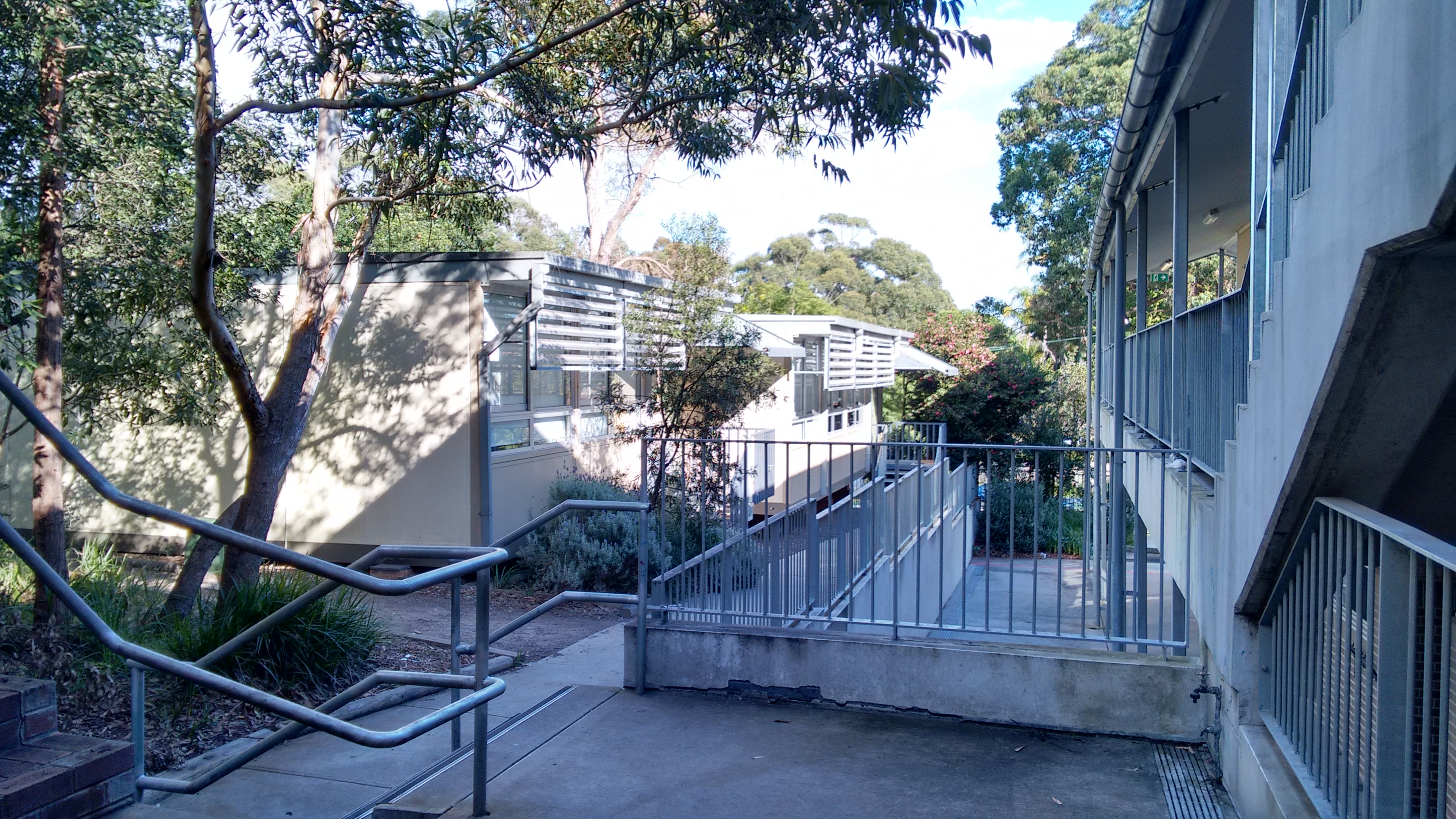
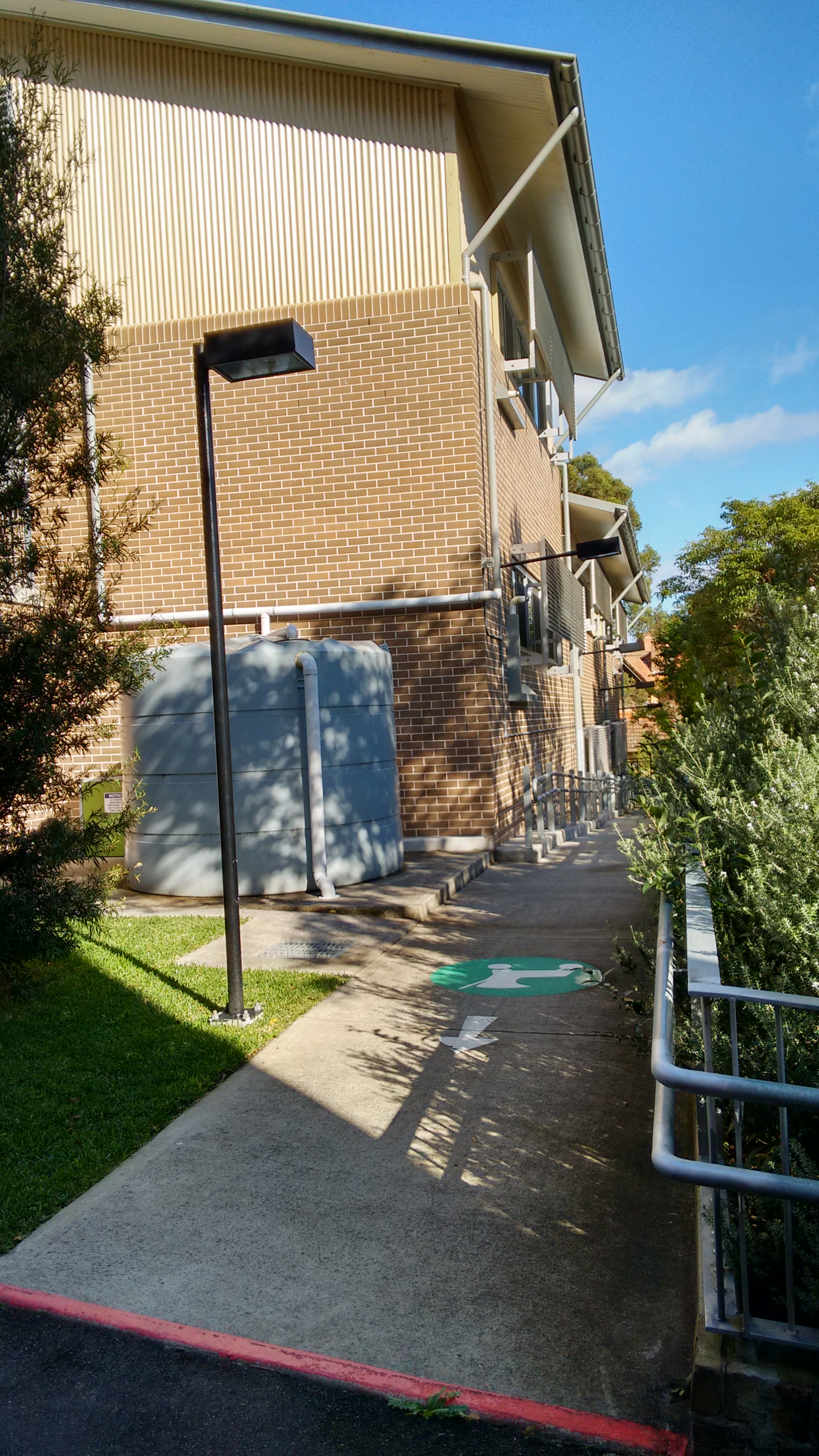
As with a lot of public schools in the old established suburbs, the school is very crowded, the school ground is occupied with a mix of old and new buildings along with obligatory demountable as well. However, there is still a decent amount of playground and open spaces. That being said with close one thousand students, it is still going to be very crowded, it is not likely a lot more can be fit into the existing grounds.

IMG_20150606_101904868_HDR

IMG_20150606_102120579_HDR IMG_20150606_102100952_HDR

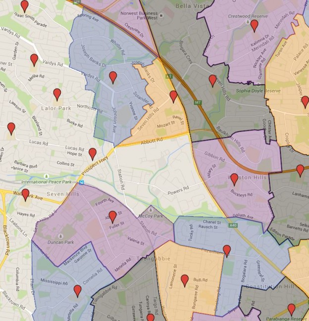
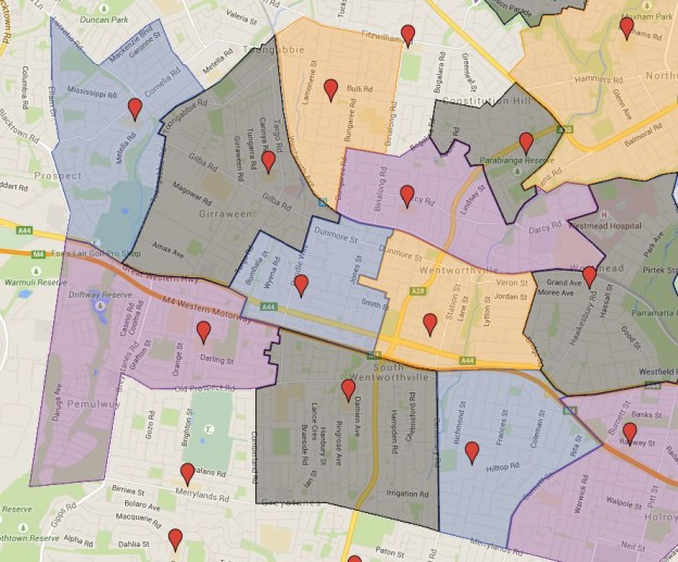
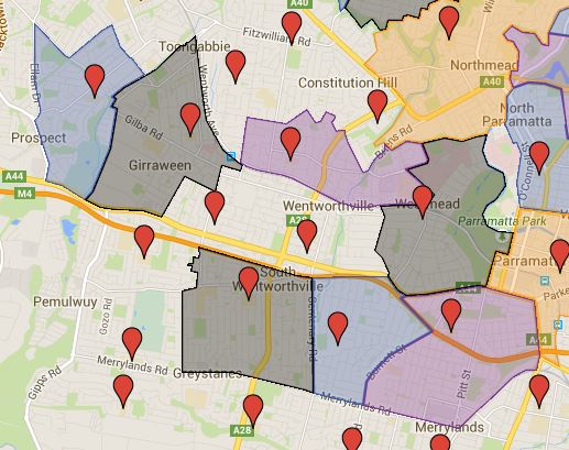
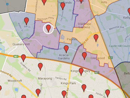
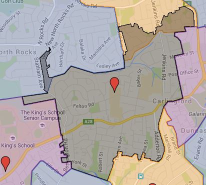
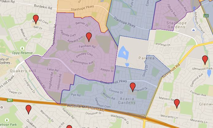
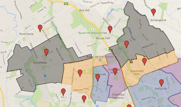
With the amount of the new apartments being built, the school catchment is likely to shrink significantly in the near future. You can search for a particular school or address in the search box in the top right-hand corner of the embedded map or zoom into an area of interest on the map.

与往常一样,我们建议您与有关学校或教育部联系,以获得相关信息的最终确认。 NSW and Sydney Public School Catchment Map 通过点击此链接。

Parklea Public School, Caddies Creek Public School and Hambledon Public School Catchment Added

Three more public school catchment map added in North West Sydney growth area, they are as following.

  • Parklea Public School
  • Caddies Creek Public School
  • Hambledon Public School

As usual contact the school in question or Department of Education for the final confirmation and you can also access the full NSW and Sydney Public School Catchment Map 通过点击此链接。

分享这个帖子:

Major update to Carlingford West Public School Catchment and also added Barnier and Quakers Hill East Public School Catchment

Major updates to Carlingford West Public School Catchment, I have redrawn the border of this public school with the latest data from March 2015. There is significant overlap with the surrounding public schools, some could be zones that covered for both school and some maybe due to the surrounding schools have not updated their catchment information yet. This easily qualified as one of the more difficult map to create due to the extreme irregular and random way the particular catchment is. I suspect Murray Farm Public School’s catchment actually shrunk this year with the Carlingford West Public School’s catchment shrunk in the south but expanded in the north towards the Murray Farm Public School.

Barnier and Quakers Hill Public School catchment


Two additional public school added and they are as following

  • Barnier Public School
  • Quakers Hill East Public School

As usual contact the school in question or Department of Education for the final confirmation and you can also access the full NSW and Sydney Public School Catchment Map 通过点击此链接。

分享这个帖子:

Artarmon Public School

Artarmon public school in Sydney, NSW was established in 1910 and currently occupy a split site only meters away from west of Artarmon railway station. It had 980 students enrolled in 2014 and only 667 in 2008. In 2014 students with a language background other than English sits at 71 per cent, this number is pretty high for north shore public schools. It also hosts opportunity classes for year 5 to 6.

Artarmon public has a very good reputation academically and consistently rank number one or two in the state. This obviously helped by the OC classes it hosts.

2010201120122013
Ranking5722

Like many schools located in the old established suburbs, space is a premium. This is particularly true as Sydney is experiencing a dramatic increase in the number of students enrolling in the state public schools. The increase in a number of students experienced by Artarmon public school is by no means unique in the north shore area. As a consequence what available space in the school is almost fully occupied by the demountable classrooms. Luckily the school is located right next to a park which would have made things much easier.

I took a screenshot in the Google map and circled the school area and as you can see play area would be at a premium here with close to 1000 students. You can search for a particular school or address in the search box in the top right-hand corner of the embedded map or zoom into an area of interest on the map.

Overall speaking I’d say Artarmon public school is very good with convenient and easy to access location. It located in the heart of north shore suburbs. However, with the number of new apartments being built up, you can reasonably expect the school catchment to shrink in the coming years. There is just not much more space to try cram more students onto the existing ground.

Artarmon public school building

Also see the follow up article on Artarmon Public School at 这里.

As usual contact the school in question or Department of Education for the final confirmation and you can also access the full NSW and Sydney Public School Catchment Map 通过点击此链接。

分享这个帖子:

Email This Post 通过电子邮件分享此帖

Six more public school catchment in north west Sydney added

Six more public school catchment added in north west Sydney. They are the following

  • Beaumont Hills Public School
  • Ironbark Ridge Public School
  • John Palmer Public School
  • Kellyville Ridge Public School
  • Riverbank Public School
  • Schofields Public School

The Riverbank public school is a brand new one just opened in 2015, its catchment is pretty much taken out from the Schofields Public School’s drawing area. North west Sydney is a popular new growth area with rapid increase in population, it is reasonable to expect more schools will be added in the future as well.

As usual contact the school in question or Department of Education for the final confirmation and you can also access the full NSW and Sydney Public School Catchment Map 通过点击此链接。

分享这个帖子:

Victoria Avenue Public School and Catchment Map Added

One of the user pointed out that I am missing this particular school, I looked up it had just opened in 2015. Unfortunately I could not figure out the exact changes to the Concord West Public School’s catchment. Concord West Public School had to be under extreme pressure with all the apartment buildings going up in the area. So it stands to reason when a new school was created specifically to relieve its pressure there would be significantly catchment changes. I found reference on its enrolment policy saying so; unfortunately I was not able to locate the catchment map it mentioned.

The net result is that the current catchment map of Victoria Avenue Public School is likely to be fairly inaccurate especially on the side of Concord West Public School.

You can access the full map by following the link.

Roselea Public School Catchment Added

Google map missed this public school when I created the catchment map for Sydney. I have mistakenly merged its school catchment with the Epping West Public School’s catchment area. This now has been rectified and the catchment map should be more accurate. However it is to be understanding that Epping West Public is considering shrinking its school catchment significantly probably due to its recent popularity, so the surrounding zones may change again very soon. I will try to keep it up to date as possible.

与往常一样,我们建议您与有关学校或教育部联系,以获得相关信息的最终确认。 NSW and Sydney Public School Catchment Map 通过点击此链接。

分享这个帖子:

zh_CN简体中文