For people who are not familiar with the Australian education system, this is a bit of general information entry. Education is the responsibility of each State, they are however funded at State and Federal levels. Each Australian State is responsible for the day-to-day running of schools within their territories. With each state responsible for education in its own territory, there are both subtle and significant differences in how the school Catchment/School Zone/Local Drawing Area is defined in each state.
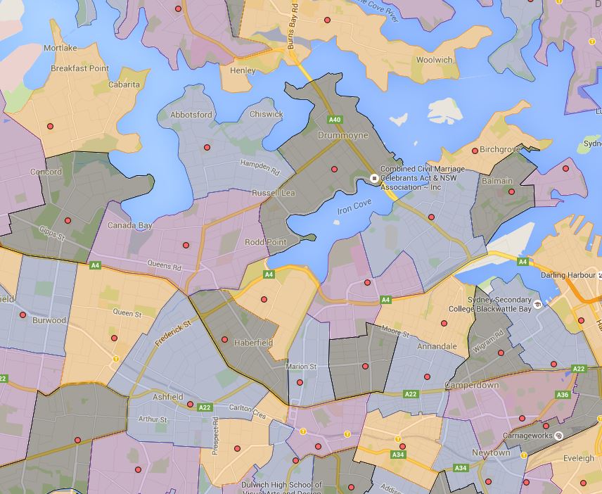
I have been creating Sydney Public School catchment maps and making them public for the last year. In Sydney, each public school has their own specific catchment area that is often bounded by major roads, and geographic separations such as rivers, creeks, parks etc. The shape of the catchment boundaries is generally irregular and in general, there is no overlap from school to school. The catchment is defined by the NSW Department of Education and they may shrink or expand depending on the enrolment number and space available at each public school in question. In Sydney, the school question is legally obligated to accept the students if he or she resides within the catchment of the school in question.
Following is a sample of Sydney Inner West Public School to illustrate the case.
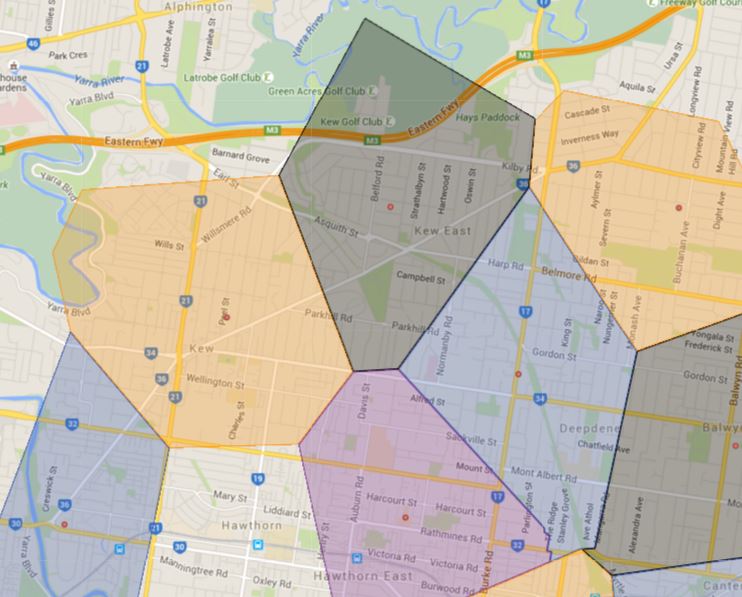
For Melbourne Australia’s second-largest city, the system is very different. First of all, it is not called the catchment, but a “Local Neighbourhood Zone”. However, the school in question often refer to it also as a catchment, school zone etc. In the past, the rule for Melbourne is that you are zoned for the closest school to your residence from the front door of the school. So it use to be where you can pull out a ruler and measure it on a map and be able to determine fairly reliably which primary school catchment/zone your current address will fall into. What happens with this rule is that the actual representation of the school catchment/zone will look like a polygon, please refer to the following image as an example.
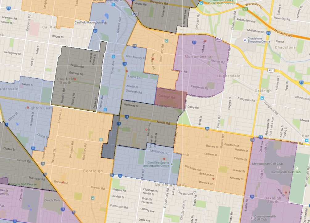
I suspect this model was adopted originally because there is not much enrolment pressure and students likely could have gone to the neighbouring schools should they wish to most of the time. However with the recent enrolment pressure, a large number of inner Melbourne city primary schools have now got specific school catchment/zone very much like their Sydney counterpart, this number is going up rapidly and in a few years, the inner Melbourne school catchment map will likely look very similar to what Sydney look like now. One thing to note is that schools with specific zoning often have overlaps between neighbouring schools. So if students in question reside in that overlapping area, they have the option of choosing which school they wish to attend.
Also with the increasing enrolment pressure in inner Melbourne, a lot of schools have also got an enrolment ceiling in place which means once that is reached they will not accept further enrolment even if the student in question resides within the official school catchment/zone area.
An example of the Sydney-style school catchment/zone that is happening more regularly in inner Melbourne city.
As usual contact the school in question or the Department of Education for the final confirmation on the school catchment/zone matter.
Terrible, does not give straightforward answer, need to take a look at the map, simple
Hi Tanya,
Thank you for your feedback. This is a very old blog entry written close to a decade ago, this is more like a daily ramble on what I learned about school zones during the period. At the time there is very little public information on the catchment and school zones in most parts of Australia. I had to piece together information from many difficult sources. There is far more information available publically nowadays regarding the school zones and maps are also vastly improved. The maps in their current form simply would not be possible with all the newly released information within the last few years.
I also fixed up the language up a bit with this old entry, hopefully it is a bit more readable. All the maps can accessed directly from the top menu bar for people who wanted to go directly there.